
No caption
IMG_7995 2.JPG
Details
Friday, May 23, 2025 · 11:48 AM
39.39471, -120.02161· 1648m
Location Context
1 / 5
USGS Topo
No elevation data
FEMA Flood
No flood data
OSM Infra
No address data
USDA Soil
No soil data
USGS Hydro
No hydro data
Apple iPhone 16 Pro
iPhone 16 Pro back triple camera 6.765mm f/1.78
6.764999865652793mmf/1.7799999713880651/1361sISO 80
Flash did not fire, compulsory flash mode
Show all EXIF (43 fields)
ApertureValue1.6638
BrightnessValue7.9838
ColorSpace65535
CompositeImageGeneral Composite Image
ExifImageHeight4284
ExifVersion2.3.2
ExposureCompensation0
ExposureModeAuto
ExposureProgramNormal program
FlashpixVersion1.0
FocalLengthIn35mmFormat24
GPSDateStamp2025:05:23
GPSDestBearing73.0601
GPSDestBearingRefTrue North
GPSHPositioningError5.7066
GPSImgDirection73.0601
GPSImgDirectionRefT
GPSSpeed0
GPSSpeedRefK
GPSTimeStamp18:48:26
HostComputeriPhone 16 Pro
latitude39.3947
LensInfo2.2200, 15.6600, 1.7800, 2.8000
LensMakeApple
longitude-120.0216
MeteringModePattern
ModifyDate2025-05-23T11:48:26.000Z
OffsetTime-07:00
OffsetTimeDigitized-07:00
OffsetTimeOriginal-07:00
ResolutionUnitinches
SceneCaptureTypeStandard
SceneTypeDirectly photographed
SensingMethodOne-chip color area sensor
ShutterSpeedValue10.4100
Software18.5
SubjectArea{"0":2851,"1":2137,"2":3141,"3":1884}
SubSecTimeDigitized996
SubSecTimeOriginal996
WhiteBalanceAuto
XResolution72
YCbCrPositioning1
YResolution72
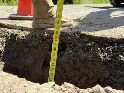
AI Analysis
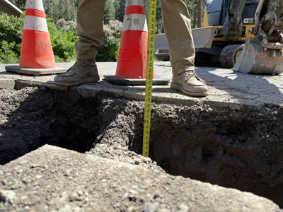
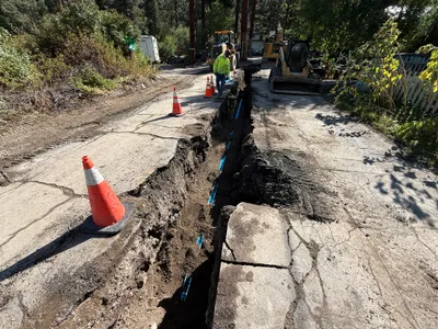
The image shows an open excavation on a paved surface with a measuring tape indicating depth. Two traffic cones and a worker's boots are beside the trench. An excavator is visible in the background. The image seems to document or inspect the dimensions of an open pothole used for utility locating.
excavation
paved surface with excavation clear day with natural light open access around the trench
Traffic cones and work boots are visible as safety measures; open trench poses a hazard.
Equipment & Materials
AI Tags
Analyzed Apr 21, 2026
Nearby Photos
1m
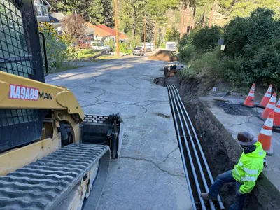
trenching
trenchingexcavation
backhoe
1m
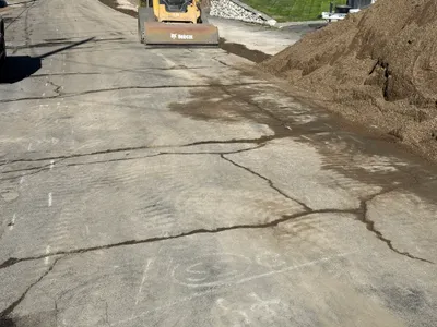
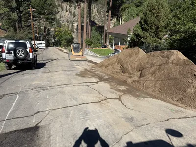
paving surface restoration
road-repairpavement-crack-repair
compact loader
1m
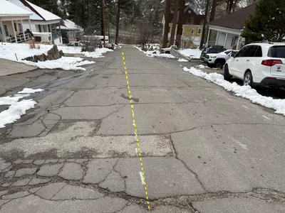
survey layout
surveyroad-layout
parked-cars
2m
trenching
trenchingconduit-installation
crawler loader
2m
site grading
site-gradingsurface-preparation
skid-steer-loader
2m
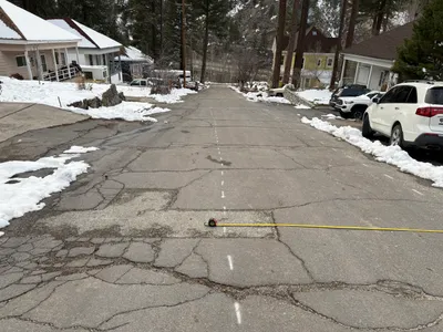
paving surface restoration
surface-assessmentalignment-marking
white SUV
3m
excavation
depth-measurementutility-locating
tape-measure
3m
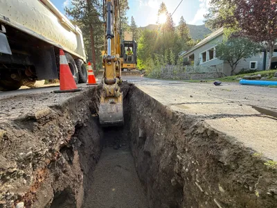
trenching
trenchingexcavation
excavator
4m
paving surface restoration
paving-surface-restorationroad-grading
skid-steer-loader
4m
pipeline installation
conduit-installationtrenching-work
excavator