No caption
IMG_7977 2.JPG
Details
Friday, May 23, 2025 · 8:44 AM
39.39468, -120.02130· 1654m
Location Context
1 / 5
USGS Topo
No elevation data
FEMA Flood
No flood data
OSM Infra
No address data
USDA Soil
No soil data
USGS Hydro
No hydro data
Apple iPhone 16 Pro
iPhone 16 Pro back triple camera 6.765mm f/1.78
6.764999865652793mmf/1.7799999713880651/453sISO 80
Flash did not fire, compulsory flash mode
Show all EXIF (43 fields)
ApertureValue1.6638
BrightnessValue6.4859
ColorSpace65535
CompositeImageGeneral Composite Image
ExifImageHeight4284
ExifVersion2.3.2
ExposureCompensation0
ExposureModeAuto
ExposureProgramNormal program
FlashpixVersion1.0
FocalLengthIn35mmFormat24
GPSDateStamp2025:05:23
GPSDestBearing354.3407
GPSDestBearingRefTrue North
GPSHPositioningError7.6098
GPSImgDirection354.3407
GPSImgDirectionRefT
GPSSpeed0.4366
GPSSpeedRefK
GPSTimeStamp15:44:47
HostComputeriPhone 16 Pro
latitude39.3947
LensInfo2.2200, 15.6600, 1.7800, 2.8000
LensMakeApple
longitude-120.0213
MeteringModePattern
ModifyDate2025-05-23T08:44:47.000Z
OffsetTime-07:00
OffsetTimeDigitized-07:00
OffsetTimeOriginal-07:00
ResolutionUnitinches
SceneCaptureTypeStandard
SceneTypeDirectly photographed
SensingMethodOne-chip color area sensor
ShutterSpeedValue8.8237
Software18.5
SubjectArea{"0":2851,"1":2137,"2":3141,"3":1884}
SubSecTimeDigitized839
SubSecTimeOriginal839
WhiteBalanceAuto
XResolution72
YCbCrPositioning1
YResolution72
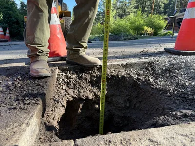
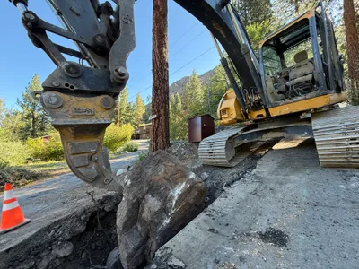
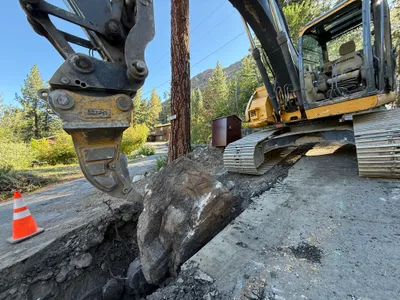
AI Analysis
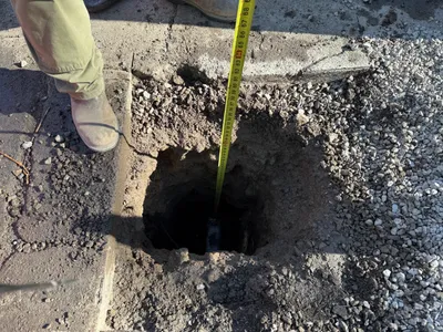
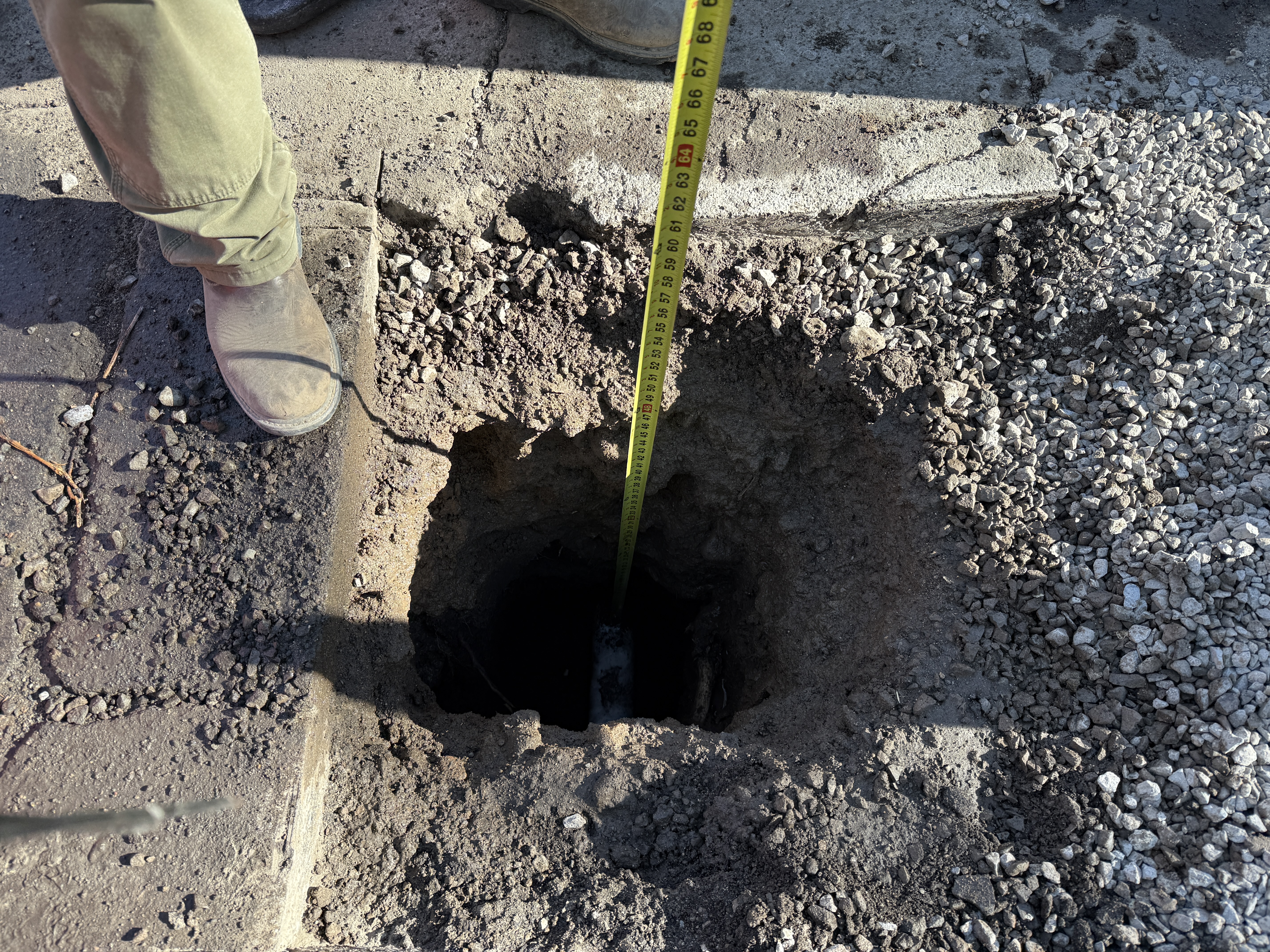
The image depicts an excavation site where a pothole has been dug into a paved surface for utility locating. A person is using a measuring tape to measure the depth of the hole. Loose gravel is visible around the site, and the ground shows rough, uneven conditions.
excavation
paved surface with loose gravel well-lit with direct sunlight open access with uneven ground
PPE such as work boots are visible, but no other safety controls are noted.
Equipment & Materials
AI Tags
Analyzed Apr 21, 2026
Nearby Photos
2m
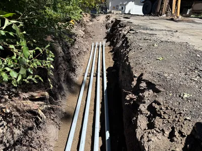
pipeline installation
trenchingconduit-installation
conduits
2m
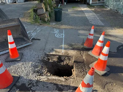
excavation
pothole-utility-locatingpothole
bucket
2m
excavation
pothole-measurementutility-locating
measuring-tape
3m
trenching
trenchingexcavation-work
excavator
3m
excavation
pothole-utility-locatingutility-excavation
loose-gravel
4m
excavation
pothole-utility-locatingtraffic-cones
loader
4m
excavation
excavationrock-removal
excavator
4m
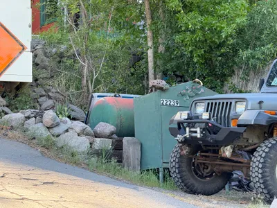
other
jeepmetal-container
jeep
4m
excavation
rock-removaltrenching
excavator
4m
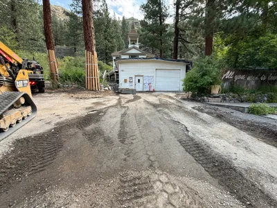
site grading
site-preparationearthworks
tracked-loader