No caption
IMG_8237.JPG
Tags
Details
Thursday, June 5, 2025 · 12:00 PM
39.39220, -120.02146· 1663m
Location Context
1 / 5
USGS Topo
No elevation data
FEMA Flood
No flood data
OSM Infra
No address data
USDA Soil
No soil data
USGS Hydro
No hydro data
Apple iPhone 16 Pro
iPhone 16 Pro back triple camera 6.765mm f/1.78
6.764999865652793mmf/1.7799999713880651/5714sISO 80
Flash did not fire, compulsory flash mode
Show all EXIF (43 fields)
ApertureValue1.6638
BrightnessValue10.2555
ColorSpace65535
CompositeImageGeneral Composite Image
ExifImageHeight4284
ExifVersion2.3.2
ExposureCompensation0
ExposureModeAuto
ExposureProgramNormal program
FlashpixVersion1.0
FocalLengthIn35mmFormat24
GPSDateStamp2025:06:05
GPSDestBearing341.7738
GPSDestBearingRefTrue North
GPSHPositioningError2.8377
GPSImgDirection341.7738
GPSImgDirectionRefT
GPSSpeed0.8176
GPSSpeedRefK
GPSTimeStamp19:0:42
HostComputeriPhone 16 Pro
latitude39.3922
LensInfo2.2200, 15.6600, 1.7800, 2.8000
LensMakeApple
longitude-120.0215
MeteringModePattern
ModifyDate2025-06-05T12:00:42.000Z
OffsetTime-07:00
OffsetTimeDigitized-07:00
OffsetTimeOriginal-07:00
ResolutionUnitinches
SceneCaptureTypeStandard
SceneTypeDirectly photographed
SensingMethodOne-chip color area sensor
ShutterSpeedValue12.4804
Software18.5
SubjectArea{"0":2851,"1":2137,"2":3141,"3":1884}
SubSecTimeDigitized434
SubSecTimeOriginal434
WhiteBalanceAuto
XResolution72
YCbCrPositioning1
YResolution72
AI Analysis
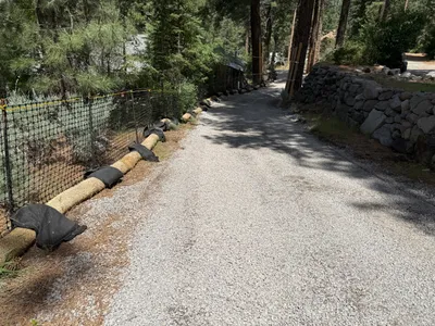
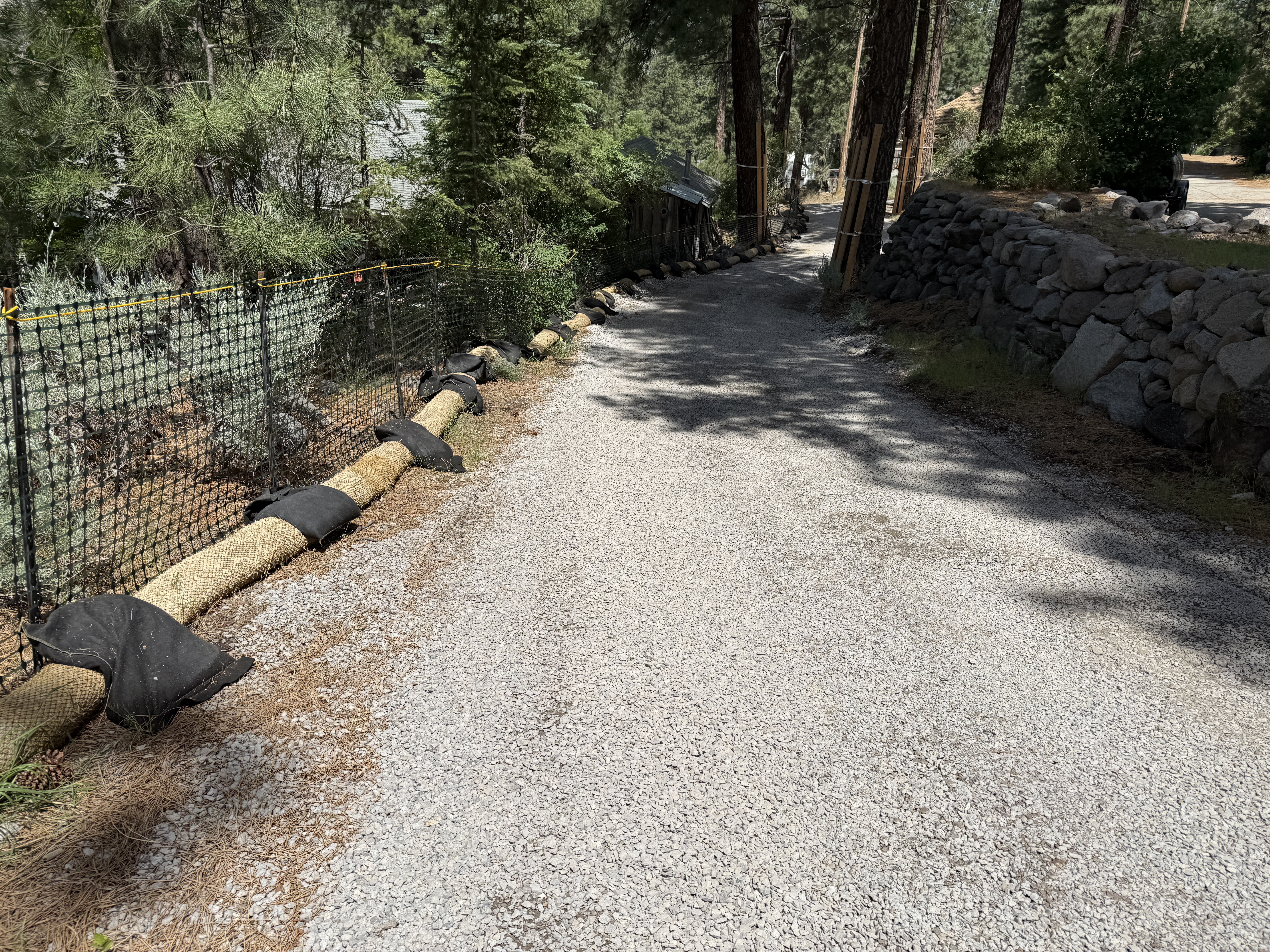
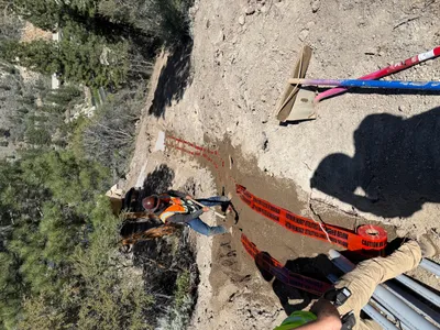
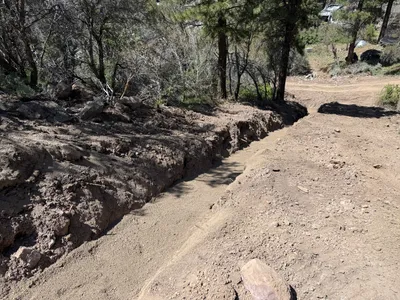
The image shows a gravel road flanked by straw wattles reinforced with sandbags and a black silt fence on the left side. The sandbags are placed at intervals to secure the wattles in position. A rock wall is visible on the right, suggesting boundary demarcation. The area is surrounded by trees, indicating a natural setting.
swppp-erosion-control
gravel road sunny and clear unobstructed access along gravel road
Safety controls such as fencing are visible; no PPE is visible in frame.
Equipment & Materials
AI Tags
Analyzed Apr 21, 2026
Nearby Photos

12m
trenching
trenchingmaterial-placement
soil
16m
paving surface restoration
road-maintenancesite-access
wooden-supports
18m
pipeline installation
pipeline-installationtrenching
sand
19m
backfill
trench-backfillhand-tool-use
shovel
19m
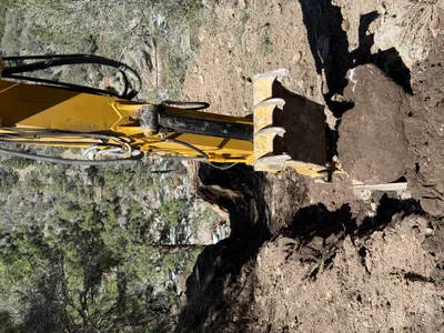
excavation
excavator-operationsite-clearing
tracked excavator
19m
trenching
trenchingtrench
20m
concrete work
foundation-preparationsite-grading
excavator
20m
trenching
trenchingexcavation
excavator
21m
trenching
trenchingexcavation
21m
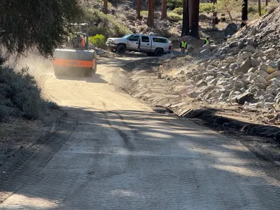
site grading
soil-compactionaccess-road-maintenance
roller-compactor