No caption
IMG_2731.JPG
Details
Thursday, January 29, 2026 · 12:15 PM
39.39139, -120.02135· 1698m
Location Context
1 / 5
USGS Topo
No elevation data
FEMA Flood
No flood data
OSM Infra
No address data
USDA Soil
No soil data
USGS Hydro
No hydro data
Apple iPhone 16 Pro
iPhone 16 Pro back triple camera 6.765mm f/1.78
6.764999865652793mmf/1.7799999713880651/9091sISO 80
Flash did not fire, compulsory flash mode
Show all EXIF (43 fields)
ApertureValue1.6638
BrightnessValue10.8379
ColorSpace65535
CompositeImageGeneral Composite Image
ExifImageHeight4284
ExifVersion2.3.2
ExposureCompensation0
ExposureModeAuto
ExposureProgramNormal program
FlashpixVersion1.0
FocalLengthIn35mmFormat24
GPSDateStamp2026:01:29
GPSDestBearing325.7050
GPSDestBearingRefTrue North
GPSHPositioningError22.9815
GPSImgDirection325.7050
GPSImgDirectionRefT
GPSSpeed1.1276
GPSSpeedRefK
GPSTimeStamp20:15:3
HostComputeriPhone 16 Pro
latitude39.3914
LensInfo2.2200, 15.6600, 1.7800, 2.8000
LensMakeApple
longitude-120.0213
MeteringModePattern
ModifyDate2026-01-29T12:15:04.000Z
OffsetTime-08:00
OffsetTimeDigitized-08:00
OffsetTimeOriginal-08:00
ResolutionUnitinches
SceneCaptureTypeStandard
SceneTypeDirectly photographed
SensingMethodOne-chip color area sensor
ShutterSpeedValue13.1502
Software26.2.1
SubjectArea{"0":2853,"1":2140,"2":3142,"3":1881}
SubSecTimeDigitized065
SubSecTimeOriginal065
WhiteBalanceAuto
XResolution72
YCbCrPositioning1
YResolution72
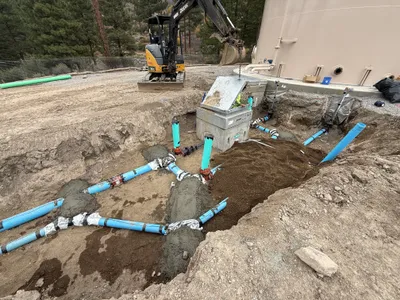
AI Analysis
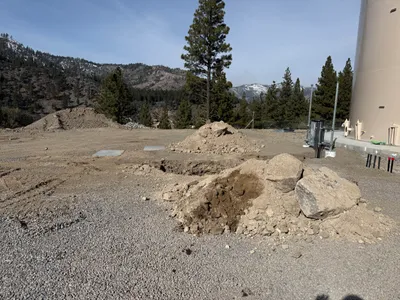
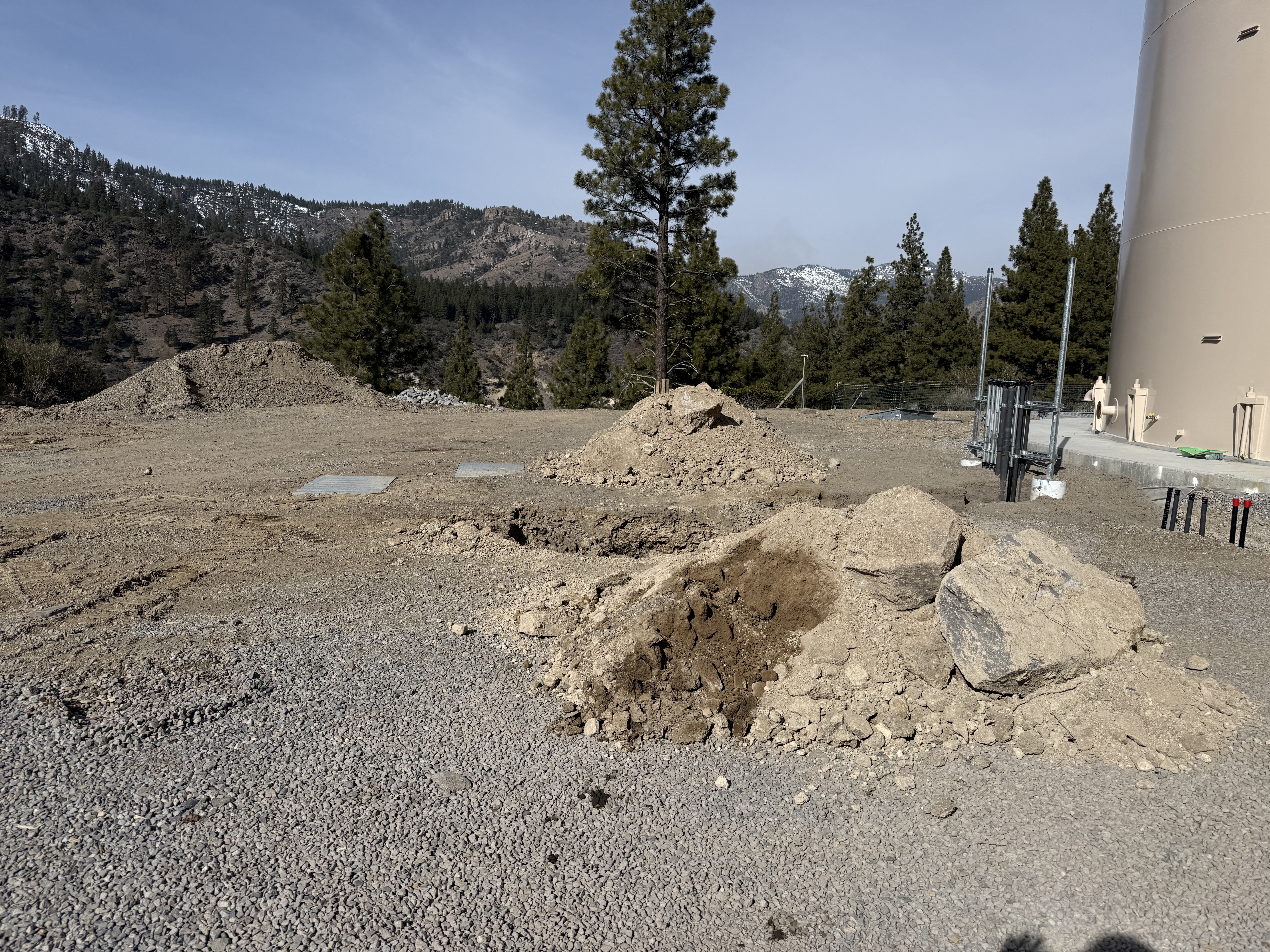
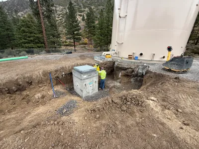
The image shows an area with excavation work ongoing, with multiple piles of dirt and rocks present. The right side shows a cylindrical structure with pipes and conduits attached. In the background, there are mountainous and forested areas. It is unclear what exactly is being installed or the specific phase of construction.
excavation
gravel and exposed dirt clear sky with sunlight open space with no apparent access issues
No specific safety features or controls are visible in the frame.
Analyzed Apr 21, 2026
Nearby Photos
2m
concrete work
foundation-constructionconcrete-placement
wood
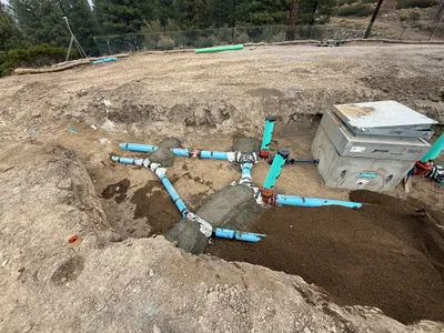
3m
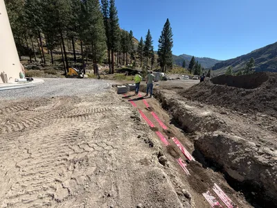
trenching
trenchingutility-installation
red warning tape
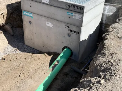
3m
valve vault
valve-vault-installationtrenching
excavation-equipment
4m
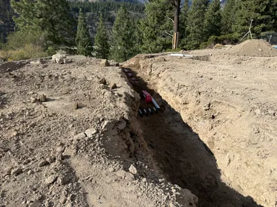
trenching
duct-bank-installationtrenching
excavator
4m
trenching
trenchingduct-installation
soil
4m
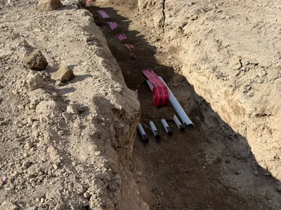
trenching
trenchingpipe-staging
plastic-pipe
4m
valve vault
valve-vault-installationpipeline-connection
excavator
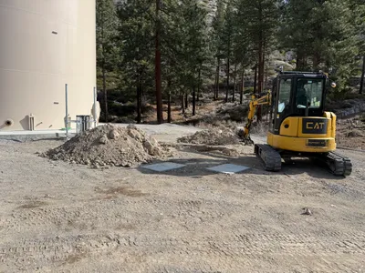
5m
excavation
excavationsite-preparation
mini-excavator
6m
pipeline installation
pipe-installationconcrete-structure
concrete
6m
valve vault
valve-vault-installationpipeline-connection
concrete