No caption
IMG_7869.JPG
Details
Monday, May 19, 2025 · 3:38 PM
39.39277, -120.02261· 1632m
Location Context
1 / 5
USGS Topo
No elevation data
FEMA Flood
No flood data
OSM Infra
No address data
USDA Soil
No soil data
USGS Hydro
No hydro data
Apple iPhone 16 Pro
iPhone 16 Pro back triple camera 6.765mm f/1.78
6.764999865652793mmf/1.7799999713880651/3953sISO 80
Flash did not fire, compulsory flash mode
Show all EXIF (43 fields)
ApertureValue1.6638
BrightnessValue9.6404
ColorSpace65535
CompositeImageGeneral Composite Image
ExifImageHeight4284
ExifVersion2.3.2
ExposureCompensation0
ExposureModeAuto
ExposureProgramNormal program
FlashpixVersion1.0
FocalLengthIn35mmFormat24
GPSDateStamp2025:05:19
GPSDestBearing179.3858
GPSDestBearingRefTrue North
GPSHPositioningError2.2127
GPSImgDirection179.3858
GPSImgDirectionRefT
GPSSpeed0.2370
GPSSpeedRefK
GPSTimeStamp22:38:58
HostComputeriPhone 16 Pro
latitude39.3928
LensInfo2.2200, 15.6600, 1.7800, 2.8000
LensMakeApple
longitude-120.0226
MeteringModePattern
ModifyDate2025-05-19T15:38:59.000Z
OffsetTime-07:00
OffsetTimeDigitized-07:00
OffsetTimeOriginal-07:00
ResolutionUnitinches
SceneCaptureTypeStandard
SceneTypeDirectly photographed
SensingMethodOne-chip color area sensor
ShutterSpeedValue11.9486
Software18.5
SubjectArea{"0":2851,"1":2137,"2":3141,"3":1884}
SubSecTimeDigitized021
SubSecTimeOriginal021
WhiteBalanceAuto
XResolution72
YCbCrPositioning1
YResolution72
AI Analysis
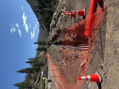
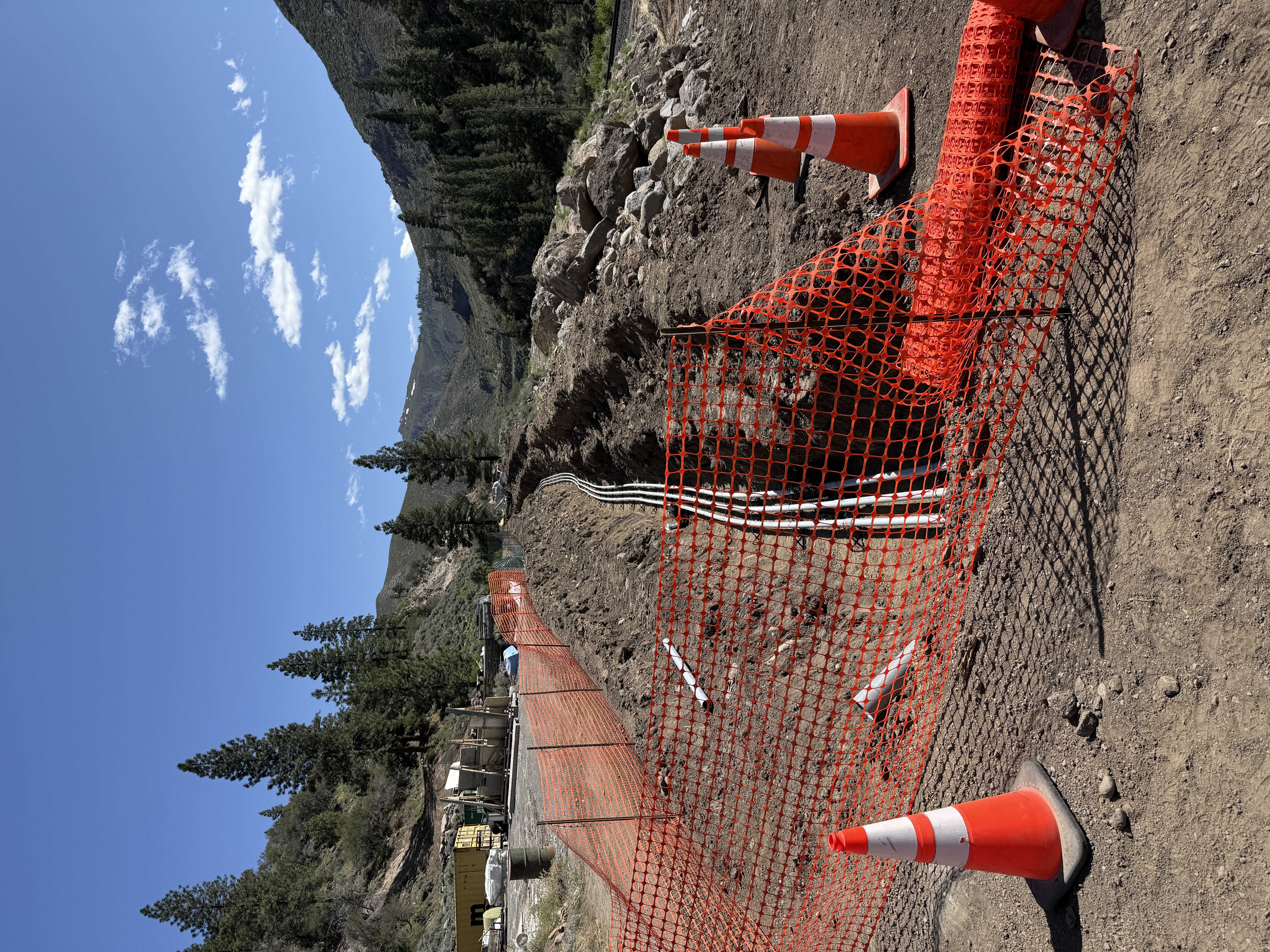
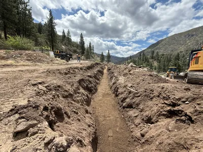
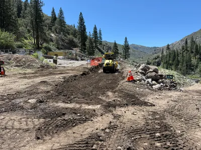
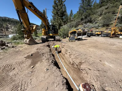
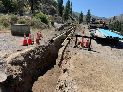
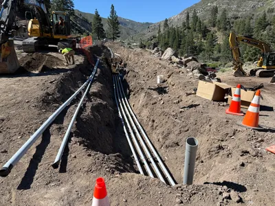
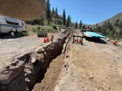
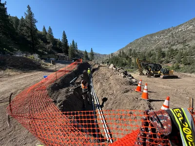
A trench runs parallel to a gravel path, lined with multiple conduits, suggesting ongoing trenching and conduit installation work. Orange safety mesh fencing and traffic cones are positioned along the trench edge, marking the area for safety. The surrounding area is mountainous with clear skies above.
trenching
gravel and soil mix around trench clear skies with good natural lighting clear access along gravel path
Safety controls such as fencing and cones are visible, but PPE is not shown.
Equipment & Materials
AI Tags
Analyzed Apr 21, 2026
Nearby Photos
1m
trenching
trenchingexcavation
bulldozer
1m
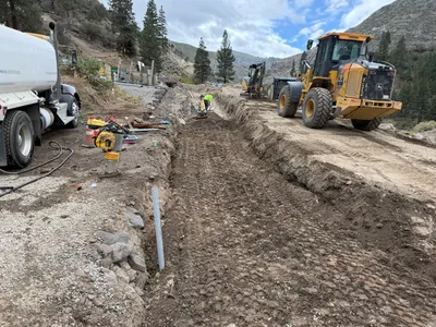
site grading
site-gradingearth-moving
roller compactor
1m
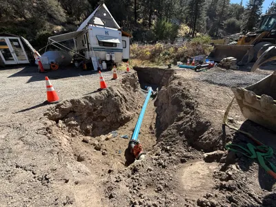
pipeline installation
trenchingpipe-installation
excavator
1m
pipeline installation
pipeline-installationtrenching
truck
1m
trenching
trenchingduct-bank-installation
excavator
1m
trenching
trenchingpipeline-installation-preparation
trailer
1m
trenching
trenchingconduit-installation
excavator

2m
pipeline installation
pipeline-installationtrenching
excavator
2m
trenching
pipe-installationtrenching
loader
2m
trenching
trenchingexcavation-activity
backhoe loader