
No caption
IMG_7782.JPG
Details
Wednesday, May 14, 2025 · 3:26 PM
39.39199, -120.02242· 1628m
Location Context
1 / 5
USGS Topo
No elevation data
FEMA Flood
No flood data
OSM Infra
No address data
USDA Soil
No soil data
USGS Hydro
No hydro data
Apple iPhone 16 Pro
iPhone 16 Pro back triple camera 6.765mm f/1.78
6.764999865652793mmf/1.7799999713880651/747sISO 64
Flash did not fire, compulsory flash mode
Show all EXIF (43 fields)
ApertureValue1.6638
BrightnessValue7.4892
ColorSpace65535
CompositeImageGeneral Composite Image
ExifImageHeight3024
ExifVersion2.3.2
ExposureCompensation0
ExposureModeAuto
ExposureProgramNormal program
FlashpixVersion1.0
FocalLengthIn35mmFormat48
GPSDateStamp2025:05:14
GPSDestBearing124.3577
GPSDestBearingRefTrue North
GPSHPositioningError51.4865
GPSImgDirection124.3577
GPSImgDirectionRefT
GPSSpeed0
GPSSpeedRefK
GPSTimeStamp22:26:4
HostComputeriPhone 16 Pro
latitude39.3920
LensInfo2.2200, 15.6600, 1.7800, 2.8000
LensMakeApple
longitude-120.0224
MeteringModePattern
ModifyDate2025-05-14T15:26:05.000Z
OffsetTime-07:00
OffsetTimeDigitized-07:00
OffsetTimeOriginal-07:00
ResolutionUnitinches
SceneCaptureTypeStandard
SceneTypeDirectly photographed
SensingMethodOne-chip color area sensor
ShutterSpeedValue9.5446
Software18.5
SubjectArea{"0":2011,"1":1508,"2":1106,"3":665}
SubSecTimeDigitized695
SubSecTimeOriginal695
WhiteBalanceAuto
XResolution72
YCbCrPositioning1
YResolution72
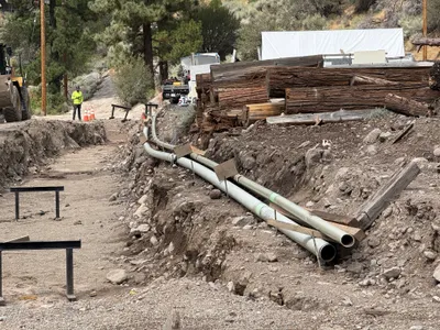
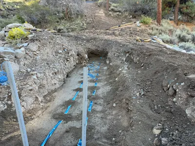
AI Analysis
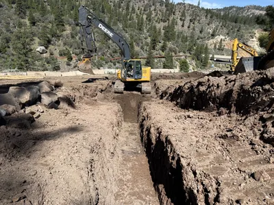
The image shows an open trench dug into the earth, with multiple pipes visible at the bottom of the trench. Surrounding the trench are piles of loose soil and large rocks. The area appears to be prepared for further installation or inspection of underground utilities.
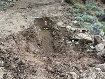
trenching
dirt and loose soil with visible rocks natural daylight, no precipitation visible open area with no apparent obstruction
No safety features are visible in frame.
Analyzed Apr 21, 2026
Nearby Photos
4m
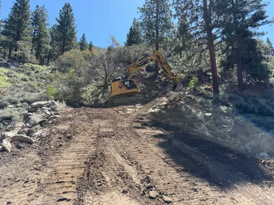
excavation
excavationearth-moving
tracked excavator
4m
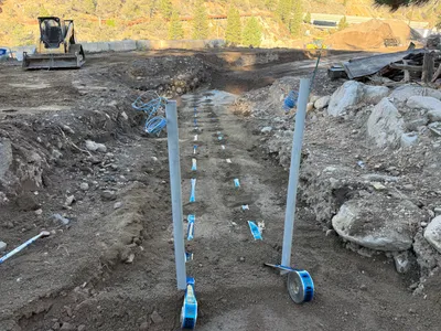
trenching
trenchingpipeline-staging
construction machinery
5m
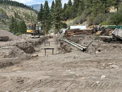
trenching
trenchingexcavation
excavator
5m
site grading
site-accessgrading
5m
trenching
trenchingconduit-preparation

5m
trenching
trenchingsite-preparation
shovel
5m
trenching
trench-inspectiontrench-preparation
hand-tools
6m
trenching
layout-measurementtrenching-activity
bulldozer
6m
trenching
trenchingearthmoving
excavator
7m
trenching
trenchingutility-preparation
bulldozer or similar