
No caption
IMG_7746.JPG
Details
Monday, May 12, 2025 · 10:20 AM
39.39194, -120.02193· 1653m
Location Context
1 / 5
USGS Topo
No elevation data
FEMA Flood
No flood data
OSM Infra
No address data
USDA Soil
No soil data
USGS Hydro
No hydro data
Apple iPhone 16 Pro
iPhone 16 Pro back triple camera 6.765mm f/1.78
6.764999865652793mmf/1.7799999713880651/1075sISO 80
Flash did not fire, compulsory flash mode
Show all EXIF (43 fields)
ApertureValue1.6638
BrightnessValue7.6795
ColorSpace65535
CompositeImageGeneral Composite Image
ExifImageHeight4284
ExifVersion2.3.2
ExposureCompensation0
ExposureModeAuto
ExposureProgramNormal program
FlashpixVersion1.0
FocalLengthIn35mmFormat24
GPSDateStamp2025:05:12
GPSDestBearing259.3770
GPSDestBearingRefTrue North
GPSHPositioningError7.3427
GPSImgDirection259.3770
GPSImgDirectionRefT
GPSSpeed0.1841
GPSSpeedRefK
GPSTimeStamp17:20:29
HostComputeriPhone 16 Pro
latitude39.3919
LensInfo2.2200, 15.6600, 1.7800, 2.8000
LensMakeApple
longitude-120.0219
MeteringModePattern
ModifyDate2025-05-12T10:20:30.000Z
OffsetTime-07:00
OffsetTimeDigitized-07:00
OffsetTimeOriginal-07:00
ResolutionUnitinches
SceneCaptureTypeStandard
SceneTypeDirectly photographed
SensingMethodOne-chip color area sensor
ShutterSpeedValue10.0705
Software18.5
SubjectArea{"0":2851,"1":2137,"2":3141,"3":1884}
SubSecTimeDigitized223
SubSecTimeOriginal223
WhiteBalanceAuto
XResolution72
YCbCrPositioning1
YResolution72
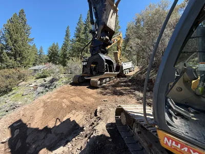
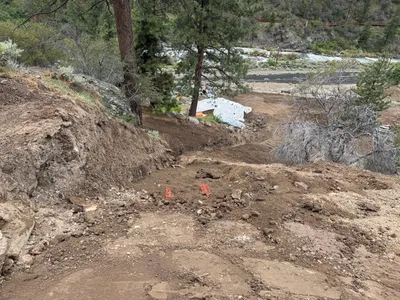
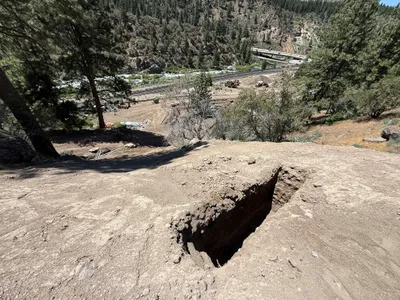
AI Analysis
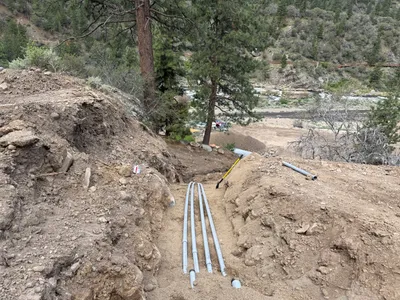
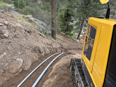
The image shows a trench dug into a hillside with multiple conduits placed parallel to each other within the trench. The trench is surrounded by loose soil, and the area appears to be part of ongoing construction work possibly for utility routing. In the background, a slope with trees and a river is visible.
trenching
soil and loose earth overcast no visible congestion or staging issues
No visible safety controls are present in the frame.
Equipment & Materials
Analyzed Apr 21, 2026
Nearby Photos
2m
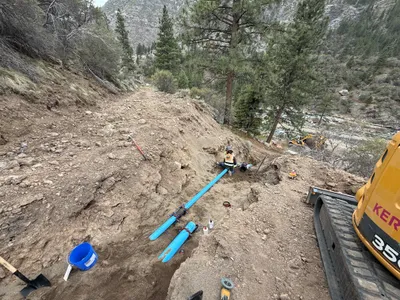
pipeline installation
pipeline-trenchingpipe-installation
excavator
2m
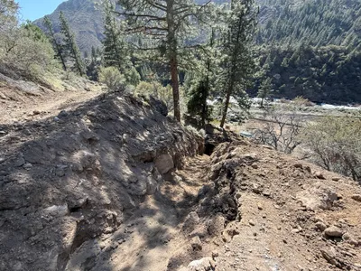
trenching
trenchinghillside-trenching
soil
2m
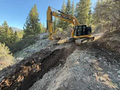
excavation
excavationearth-moving
excavator
3m
trenching
trenchingconduit-installation
excavator
3m
site grading
site-gradingearth
earth
3m
trenching
trenchingpipeline-exposure
blue pipe
3m
excavation
utility-markingsoil-backfill
soil
3m
excavation
excavationexcavator
excavator
3m
excavation
excavationsite-preparation
soil
3m
excavation
excavationearth-moving
construction-materials