No caption
IMG_0576.JPG
Details
Tuesday, September 30, 2025 · 3:41 PM
39.39274, -120.02255· 1629m
Location Context
1 / 5
USGS Topo
No elevation data
FEMA Flood
No flood data
OSM Infra
No address data
USDA Soil
No soil data
USGS Hydro
No hydro data
Apple iPhone 16 Pro
iPhone 16 Pro back triple camera 6.765mm f/1.78
6.764999865652793mmf/1.7799999713880651/240sISO 64
Flash did not fire, compulsory flash mode
Show all EXIF (43 fields)
ApertureValue1.6638
BrightnessValue5.7584
ColorSpace65535
CompositeImageGeneral Composite Image
ExifImageHeight4284
ExifVersion2.3.2
ExposureCompensation0
ExposureModeAuto
ExposureProgramNormal program
FlashpixVersion1.0
FocalLengthIn35mmFormat24
GPSDateStamp2025:09:30
GPSDestBearing176.7326
GPSDestBearingRefTrue North
GPSHPositioningError10.1709
GPSImgDirection176.7326
GPSImgDirectionRefT
GPSSpeed0.7907
GPSSpeedRefK
GPSTimeStamp22:41:19
HostComputeriPhone 16 Pro
latitude39.3927
LensInfo2.2200, 15.6600, 1.7800, 2.8000
LensMakeApple
longitude-120.0226
MeteringModePattern
ModifyDate2025-09-30T15:41:20.000Z
OffsetTime-07:00
OffsetTimeDigitized-07:00
OffsetTimeOriginal-07:00
ResolutionUnitinches
SceneCaptureTypeStandard
SceneTypeDirectly photographed
SensingMethodOne-chip color area sensor
ShutterSpeedValue7.9044
Software26.0
SubjectArea{"0":2859,"1":2140,"2":3142,"3":1881}
SubSecTimeDigitized930
SubSecTimeOriginal930
WhiteBalanceAuto
XResolution72
YCbCrPositioning1
YResolution72
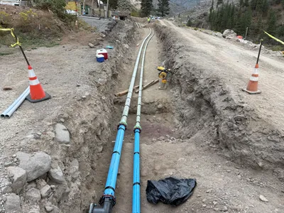
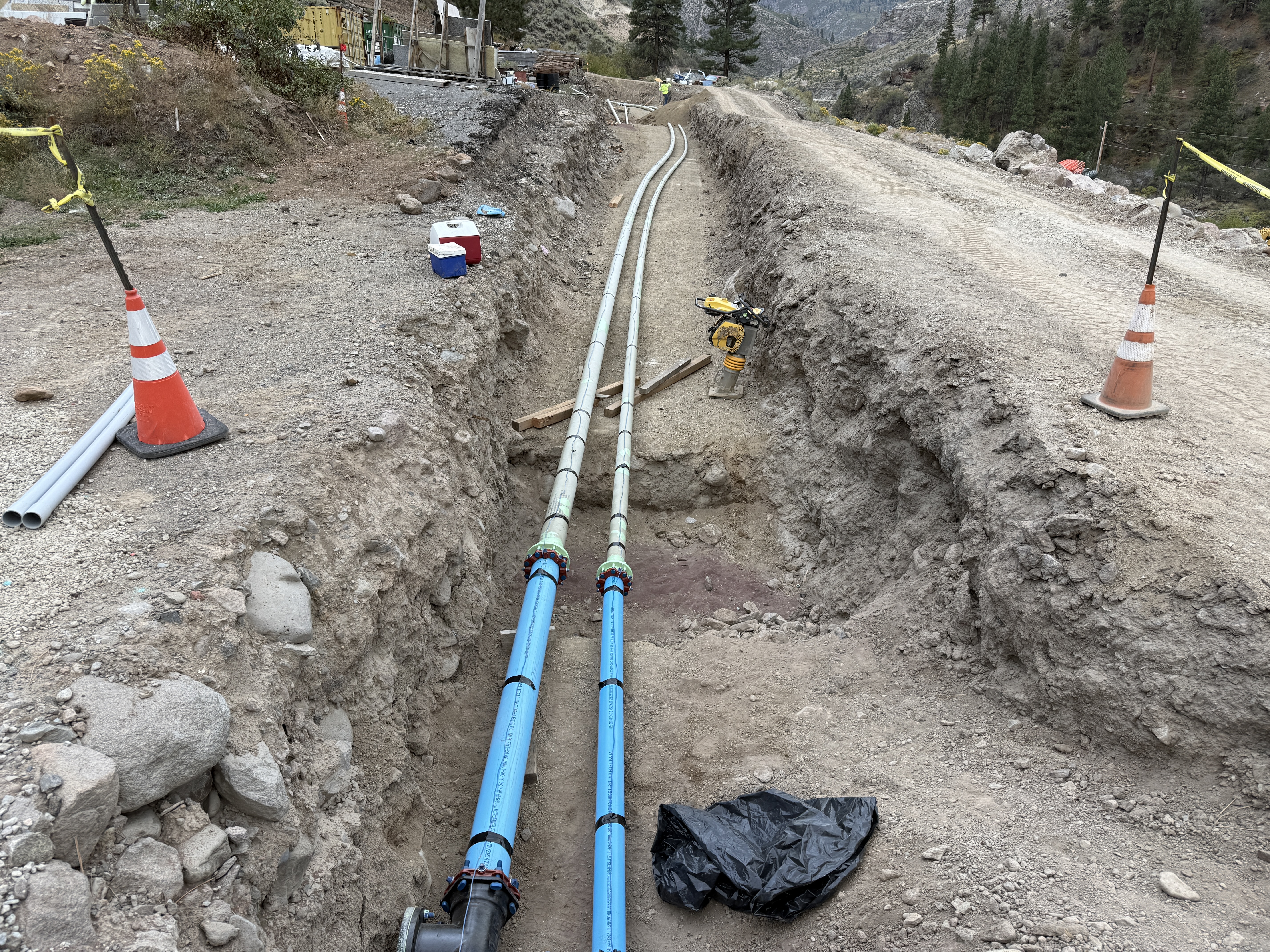
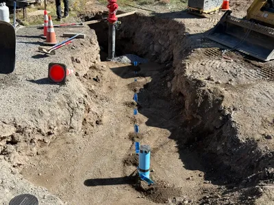
AI Analysis
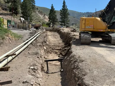
The image shows a trench with two blue pipes laid out in parallel. There are cones marking boundaries, and a compaction tool is present near the trench. The area appears to be part of a construction site in a rural setting. There are no visible workers in the photo.
pipeline-installation
dirt and rocky trench natural daylight marked boundaries with cones and tape
Safety cones and caution tape are visible around the open trench.
Equipment & Materials
AI Tags
Analyzed Apr 21, 2026
Nearby Photos
1m
backfill
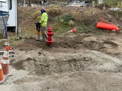
compactionfire-hydrant-installation
compactor
1m
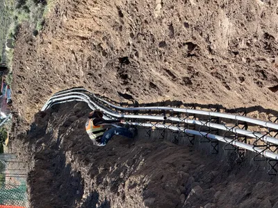
pipeline installation
duct-bank-installationconduit-placing
conduits

2m
trenching
trenchingfire-hydrant-installation
bulldozer
2m
trenching
trenchingfire-hydrant-installation
backhoe-loader
2m
trenching
trenchingexcavation
excavator
2m
trenching
trenchingpipe-installation
skid steer loader
2m
trenching
trenchingpipeline-layout
excavator
2m
trenching
trenchingexcavation-work
excavator

2m
trenching
trenchingutility-installation
tracked-loader
2m
excavation
excavationtrenching
excavator