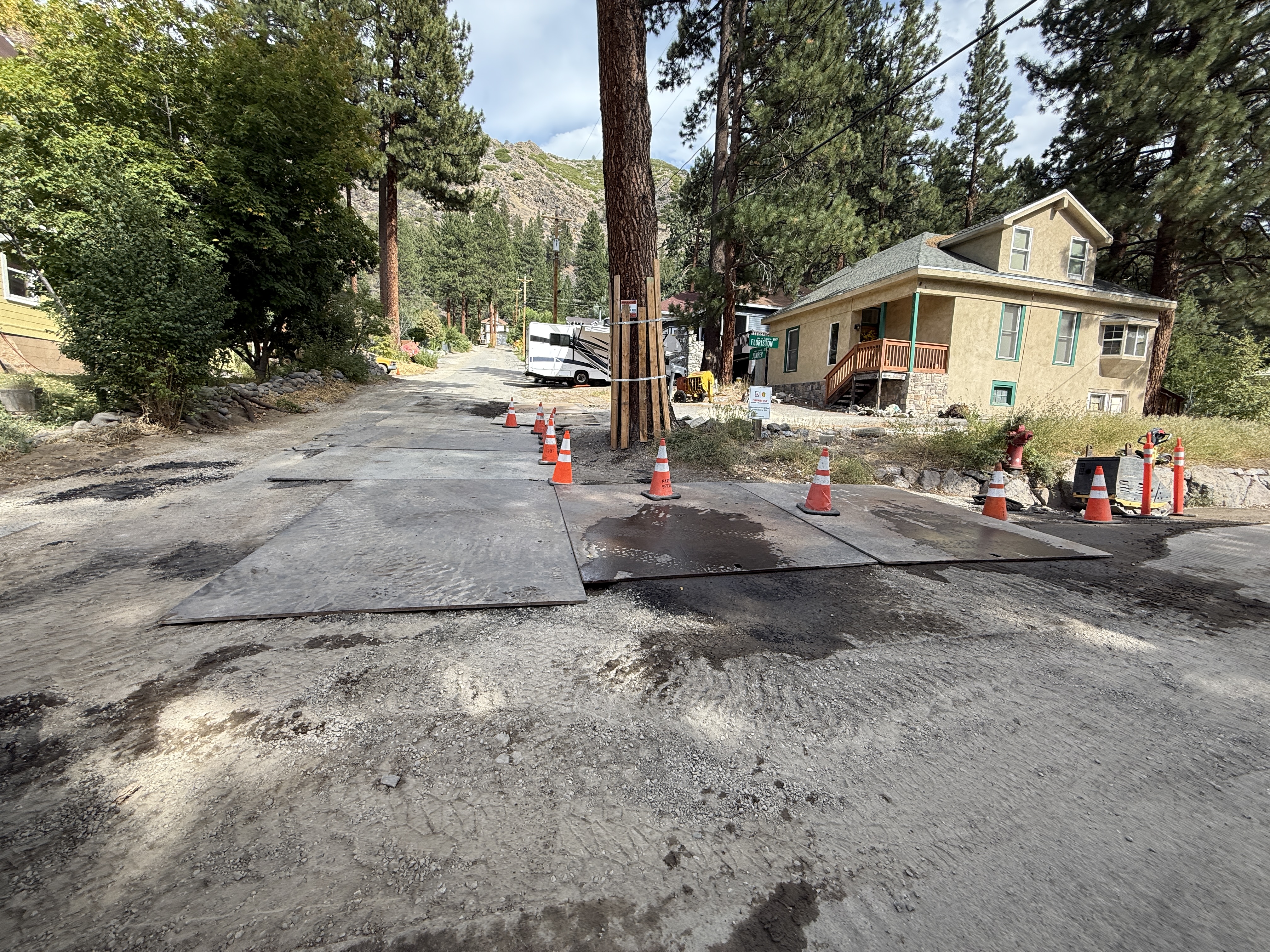
No caption
IMG_9677.JPG
Details
Friday, August 22, 2025 · 3:48 PM
39.39471, -120.02267· 1634m
Location Context
1 / 5
USGS Topo
No elevation data
FEMA Flood
No flood data
OSM Infra
No address data
USDA Soil
No soil data
USGS Hydro
No hydro data
Apple iPhone 16 Pro
iPhone 16 Pro back triple camera 2.22mm f/2.2
2.220000028611935mmf/2.21/564sISO 50
Flash did not fire, compulsory flash mode
Show all EXIF (43 fields)
ApertureValue2.2750
BrightnessValue8.0742
ColorSpace65535
CompositeImageGeneral Composite Image
ExifImageHeight3024
ExifVersion2.3.2
ExposureCompensation0
ExposureModeAuto
ExposureProgramNormal program
FlashpixVersion1.0
FocalLengthIn35mmFormat14
GPSDateStamp2025:08:22
GPSDestBearing328.5316
GPSDestBearingRefTrue North
GPSHPositioningError2.2117
GPSImgDirection328.5316
GPSImgDirectionRefT
GPSSpeed0.3708
GPSSpeedRefK
GPSTimeStamp22:48:29
HostComputeriPhone 16 Pro
latitude39.3947
LensInfo2.2200, 15.6600, 1.7800, 2.8000
LensMakeApple
longitude-120.0227
MeteringModePattern
ModifyDate2025-08-22T15:48:30.000Z
OffsetTime-07:00
OffsetTimeDigitized-07:00
OffsetTimeOriginal-07:00
ResolutionUnitinches
SceneCaptureTypeStandard
SceneTypeDirectly photographed
SensingMethodOne-chip color area sensor
ShutterSpeedValue9.1396
Software18.6.1
SubjectArea{"0":2000,"1":1511,"2":2217,"3":1330}
SubSecTimeDigitized194
SubSecTimeOriginal194
WhiteBalanceAuto
XResolution72
YCbCrPositioning1
YResolution72
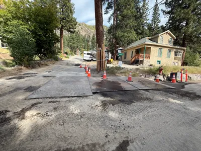
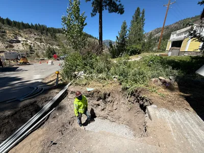
AI Analysis
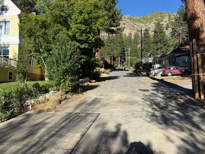
The image shows a dirt road covered by several steel plates, with traffic cones aligned to guide traffic. The road is near residential houses and flanked by large trees. The placement of the steel plates suggests an ongoing or previous subsurface excavation. No active construction work or equipment is visible.
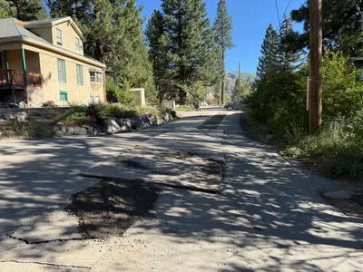
paving-surface-restoration
dirt road with steel plates partly cloudy with daylight unobstructed road access
Cones are visible for traffic guidance, but no PPE or other safety features are visible.
Equipment & Materials
Analyzed Apr 21, 2026
Nearby Photos
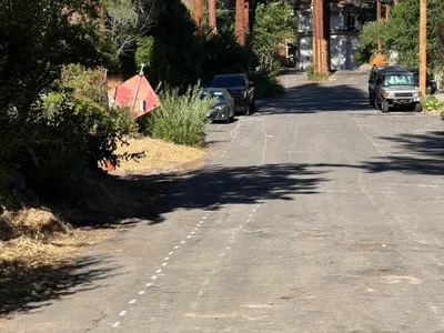
1m
paving surface restoration
painted-markingsroad-signage
cars
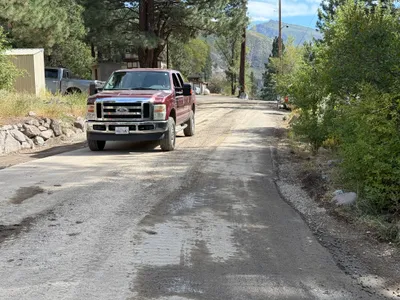
1m
other
truckroad
truck
1m
trenching
trench-excavationduct-bank-installation
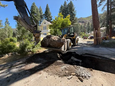
excavator
1m
excavation
excavationrock-moving
wheel loader
1m
paving surface restoration
surface-restorationasphalt-patching
asphalt
2m
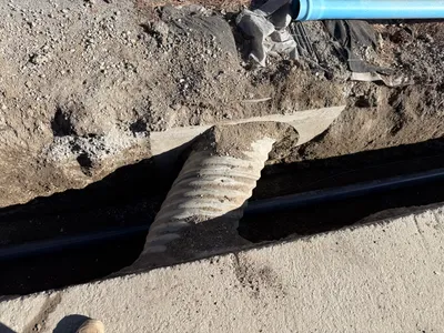
trenching
trenchingpipe-laying
corrugated-pipe
2m
trenching
trenchingroadway-excavation
loader
2m
trenching
soil-compactiontrenching
backhoe
2m
pipeline installation
pipe-installationtrenching
shovel
3m
other
residential-housesparked-cars
parked-cars