No caption
IMG_7034.JPG
Details
Monday, April 7, 2025 · 4:05 PM
39.39473, -120.02140· 1650m
Location Context
1 / 5
USGS Topo
No elevation data
FEMA Flood
No flood data
OSM Infra
No address data
USDA Soil
No soil data
USGS Hydro
No hydro data
Apple iPhone 16 Pro
iPhone 16 Pro back triple camera 6.765mm f/1.78
6.764999865652793mmf/1.7799999713880651/5319sISO 80
Flash did not fire, compulsory flash mode
Show all EXIF (43 fields)
ApertureValue1.6638
BrightnessValue10.2201
ColorSpace65535
CompositeImageGeneral Composite Image
ExifImageHeight4284
ExifVersion2.3.2
ExposureCompensation0
ExposureModeAuto
ExposureProgramNormal program
FlashpixVersion1.0
FocalLengthIn35mmFormat24
GPSDateStamp2025:04:07
GPSDestBearing95.9218
GPSDestBearingRefTrue North
GPSHPositioningError3.1710
GPSImgDirection95.9218
GPSImgDirectionRefT
GPSSpeed0.9449
GPSSpeedRefK
GPSTimeStamp23:5:4
HostComputeriPhone 16 Pro
latitude39.3947
LensInfo2.2200, 15.6600, 1.7800, 2.8000
LensMakeApple
longitude-120.0214
MeteringModePattern
ModifyDate2025-04-07T16:05:05.000Z
OffsetTime-07:00
OffsetTimeDigitized-07:00
OffsetTimeOriginal-07:00
ResolutionUnitinches
SceneCaptureTypeStandard
SceneTypeDirectly photographed
SensingMethodOne-chip color area sensor
ShutterSpeedValue12.3770
Software18.4
SubjectArea{"0":2849,"1":2137,"2":3291,"3":1884}
SubSecTimeDigitized016
SubSecTimeOriginal016
WhiteBalanceAuto
XResolution72
YCbCrPositioning1
YResolution72
AI Analysis
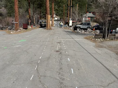
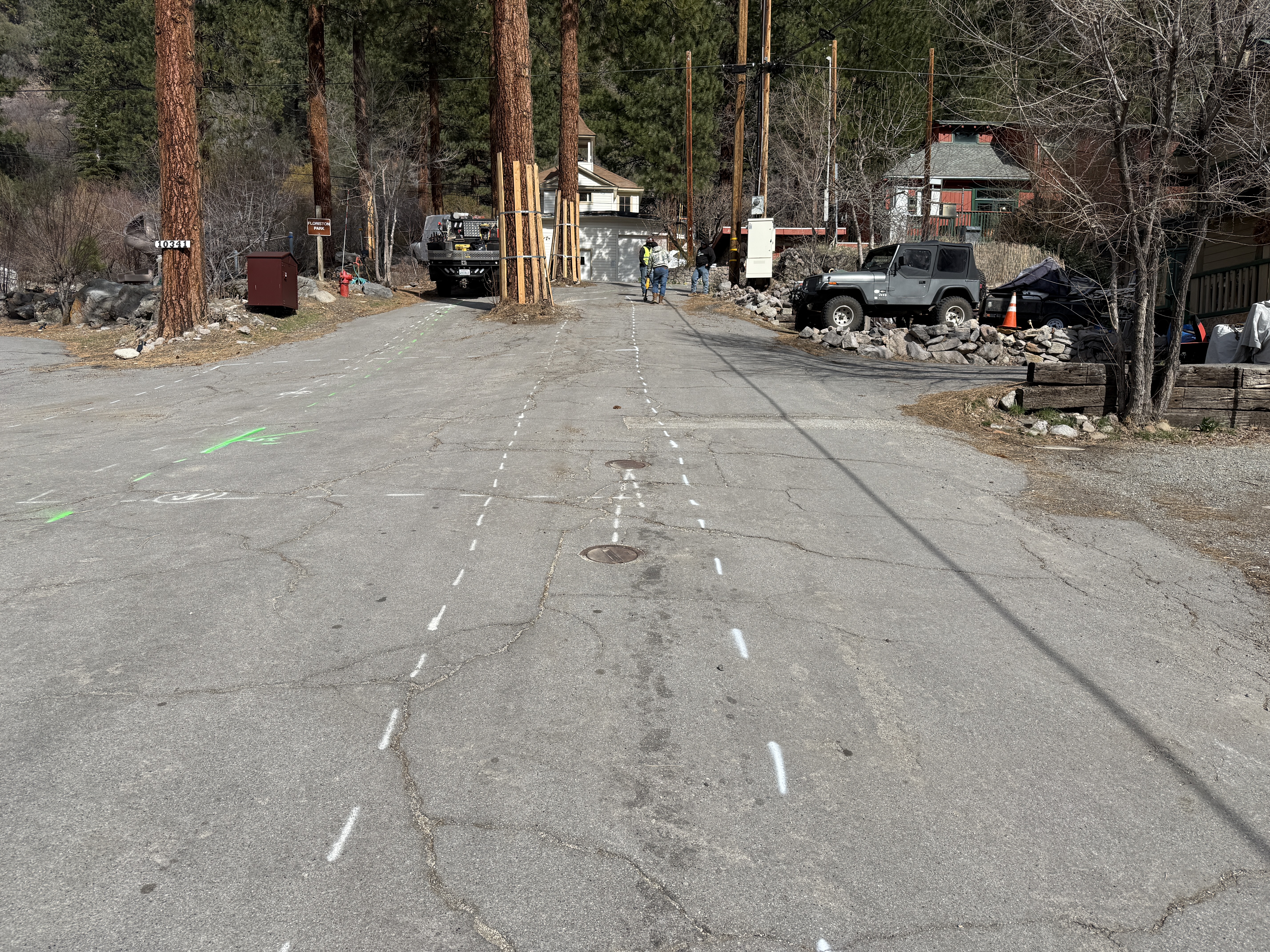
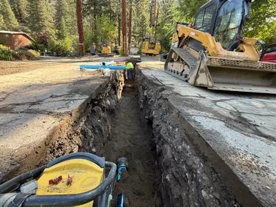
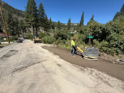
The image shows a section of a paved road with several white dashed lines and green markings, likely indicating survey layout or future work alignment. Several vehicles are visible parked along the side of the road. The surrounding area includes trees and small structures, suggesting a rural or forested setting.
survey-layout
paved road with cracks clear daylight conditions open access with roadside parking
Safety features are not visibly prominent in the frame.
Equipment & Materials
Analyzed Apr 21, 2026
Nearby Photos
1m
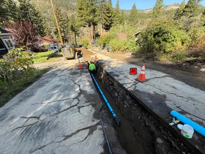
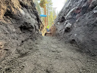
pipeline installation
pipeline-installationtrenching
small loader or excavator
1m
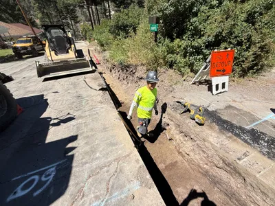
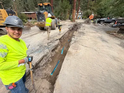
trenching
trenchingexcavation-work
skid-steer-loader
2m
trenching
trenchingearthwork
skid steer loader
3m
trenching
trenchingexcavation
soil
4m
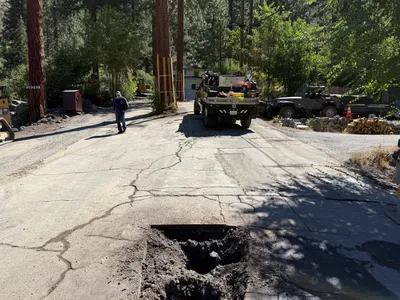
excavation
pothole-utility-locatingexcavation
utility truck
4m
trenching
trenchingdigging
backhoe
4m
excavation
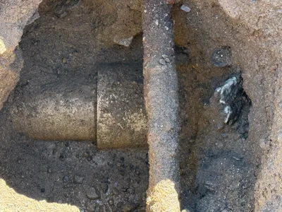
pothole-utility-locatingunderground-pipe
pipe
4m
paving surface restoration
soil-compactionsurface-restoration
loader
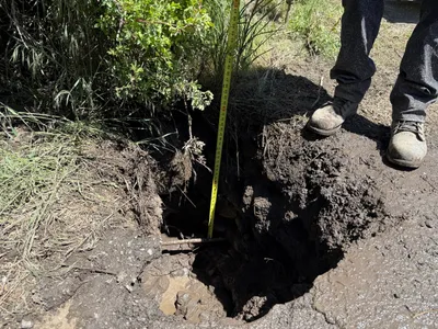
4m
excavation
pothole-excavationutility-locating
measuring-tape
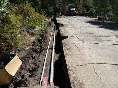
5m
trenching
trenchingduct-bank-installation
construction truck