
No caption
IMG_9535.JPG
Details
Tuesday, August 19, 2025 · 10:06 AM
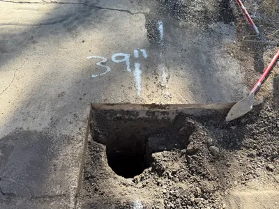
39.39467, -120.02116· 1651m
Location Context
1 / 5
USGS Topo
No elevation data
FEMA Flood
No flood data
OSM Infra
No address data
USDA Soil
No soil data
USGS Hydro
No hydro data
Apple iPhone 16 Pro
iPhone 16 Pro back triple camera 2.22mm f/2.2
2.220000028611935mmf/2.21/679sISO 64
Flash did not fire, compulsory flash mode
Show all EXIF (43 fields)
ApertureValue2.2750
BrightnessValue7.6507
ColorSpace65535
CompositeImageGeneral Composite Image
ExifImageHeight3024
ExifVersion2.3.2
ExposureCompensation0
ExposureModeAuto
ExposureProgramNormal program
FlashpixVersion1.0
FocalLengthIn35mmFormat14
GPSDateStamp2025:08:19
GPSDestBearing101.9610
GPSDestBearingRefTrue North
GPSHPositioningError4.6388
GPSImgDirection101.9610
GPSImgDirectionRefT
GPSSpeed0.1363
GPSSpeedRefK
GPSTimeStamp17:6:28
HostComputeriPhone 16 Pro
latitude39.3947
LensInfo2.2200, 15.6600, 1.7800, 2.8000
LensMakeApple
longitude-120.0212
MeteringModePattern
ModifyDate2025-08-19T10:06:28.000Z
OffsetTime-07:00
OffsetTimeDigitized-07:00
OffsetTimeOriginal-07:00
ResolutionUnitinches
SceneCaptureTypeStandard
SceneTypeDirectly photographed
SensingMethodOne-chip color area sensor
ShutterSpeedValue9.4070
Software18.6.1
SubjectArea{"0":2000,"1":1511,"2":2217,"3":1330}
SubSecTimeDigitized894
SubSecTimeOriginal894
WhiteBalanceAuto
XResolution72
YCbCrPositioning1
YResolution72
AI Analysis
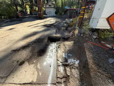
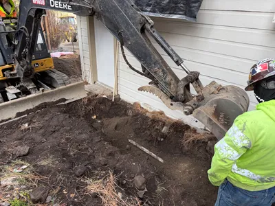
The image shows a road surface with a square pothole indicating utility location. Construction vehicles and materials are present nearby, suggesting ongoing work. There are markings on the pavement, possibly indicating underground utilities. Equipment such as a power cabinet and a hole-digging machine are visible.
excavation
paved road with pothole sunny with natural lighting and shadows open residential area with machinery staged on side
Safety features such as barriers and PPE are not visible in frame
Equipment & Materials
Analyzed Apr 21, 2026
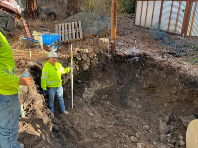
Nearby Photos
trenching
trenchingexcavation-work
excavator
1m
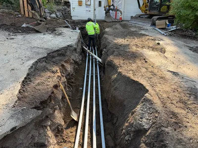
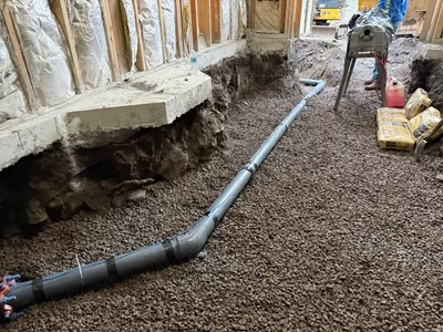
trenching
trenchingconduit-installation
excavator

1m
other
ground-preparationindoor-construction
shovel
1m
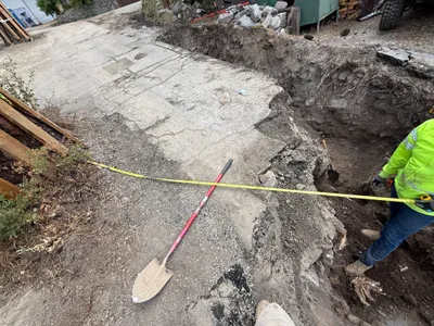
trenching
trenchingmeasurement
shovel
2m
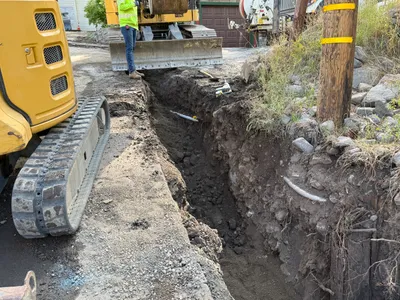
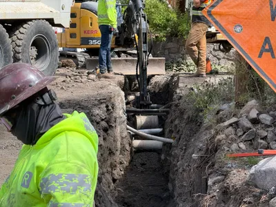
excavation
excavationtrench-digging
excavator
2m
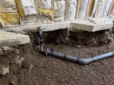
pipeline installation
pipeline-installationpipe-laying
workbench
2m
pipeline installation
trenchingpipeline-installation
gravel
2m
trenching
trenchingexcavation-work
excavator
2m
excavation
excavationpothole-utility-locating
shovel
2m
excavation
excavationsite-preparation
measuring-rod