
No caption
IMG_8081.JPG
Details
Wednesday, May 28, 2025 · 9:05 AM
39.39414, -120.02265· 1638m
Location Context
1 / 5
USGS Topo
No elevation data
FEMA Flood
No flood data
OSM Infra
No address data
USDA Soil
No soil data
USGS Hydro
No hydro data
Apple iPhone 16 Pro
iPhone 16 Pro back triple camera 2.22mm f/2.2
2.220000028611935mmf/2.21/143sISO 50
Flash did not fire, compulsory flash mode
Show all EXIF (43 fields)
ApertureValue2.2750
BrightnessValue6.0969
ColorSpace65535
CompositeImageGeneral Composite Image
ExifImageHeight3024
ExifVersion2.3.2
ExposureCompensation0
ExposureModeAuto
ExposureProgramNormal program
FlashpixVersion1.0
FocalLengthIn35mmFormat14
GPSDateStamp2025:05:28
GPSDestBearing185.0261
GPSDestBearingRefTrue North
GPSHPositioningError7.2016
GPSImgDirection185.0261
GPSImgDirectionRefT
GPSSpeed0.0936
GPSSpeedRefK
GPSTimeStamp16:5:20
HostComputeriPhone 16 Pro
latitude39.3941
LensInfo2.2200, 15.6600, 1.7800, 2.8000
LensMakeApple
longitude-120.0227
MeteringModePattern
ModifyDate2025-05-28T09:05:21.000Z
OffsetTime-07:00
OffsetTimeDigitized-07:00
OffsetTimeOriginal-07:00
ResolutionUnitinches
SceneCaptureTypeStandard
SceneTypeDirectly photographed
SensingMethodOne-chip color area sensor
ShutterSpeedValue7.1617
Software18.5
SubjectArea{"0":2000,"1":1511,"2":2217,"3":1330}
SubSecTimeDigitized017
SubSecTimeOriginal017
WhiteBalanceAuto
XResolution72
YCbCrPositioning1
YResolution72
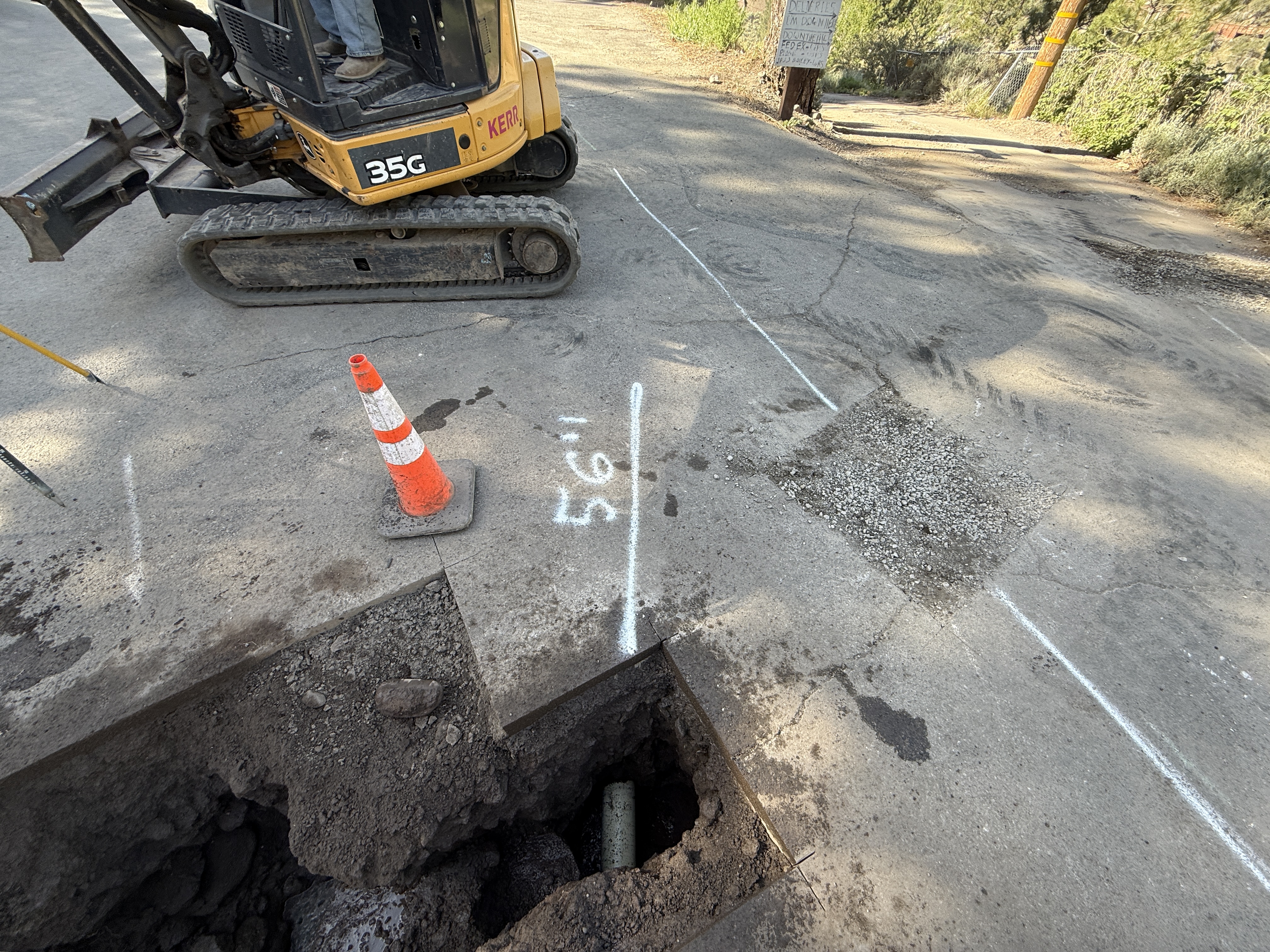
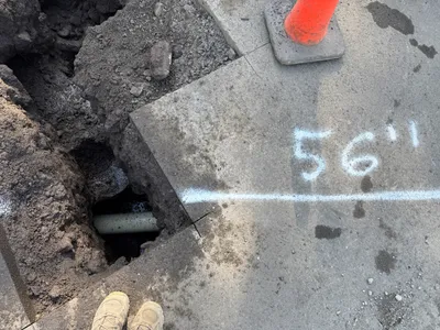
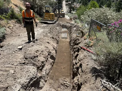
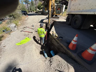
AI Analysis
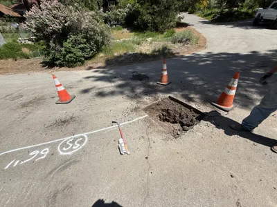
The image shows a construction scene focused on pothole utility locating. A compact excavator is present, and a small trench or hole in the pavement has been opened. A traffic cone is placed near the edge of the excavation. White spray-painted lines and measurements are visible on the pavement, possibly marking utility locations.
excavation
pavement with open trench natural daylight single-lane road access with minimal congestion
A traffic cone is used to mark the excavation area, but no other safety features are visible in frame.
Equipment & Materials
AI Tags
Analyzed Apr 21, 2026
Nearby Photos
0m
trenching
trenchingexcavation-work
excavator
1m
trenching
utility-locatingpotholing
excavator
1m
trenching
trenchingexcavation
excavator
1m
excavation
pothole-utility-locatingexcavation
pavement
1m
trenching
trenchingconduit-installation
excavator
2m
swppp erosion control
erosion-controlsurface-preparation
construction-vehicle
2m
trenching
trenchingpipeline-installation
backhoe
2m
excavation
utility-potholingpothole-excavation
truck
2m
trenching
trenchingexcavation-work
excavator
2m
trenching
trench-inspectiontrench
excavator