No caption
IMG_8055.JPG
Details
Tuesday, May 27, 2025 · 9:40 AM
39.39466, -120.02264· 1586m
Location Context
1 / 5
USGS Topo
No elevation data
FEMA Flood
No flood data
OSM Infra
No address data
USDA Soil
No soil data
USGS Hydro
No hydro data
Apple iPhone 16 Pro
iPhone 16 Pro back triple camera 2.22mm f/2.2
2.220000028611935mmf/2.21/312sISO 50
Flash did not fire, compulsory flash mode
Show all EXIF (43 fields)
ApertureValue2.2750
BrightnessValue6.6858
ColorSpace65535
CompositeImageGeneral Composite Image
ExifImageHeight3024
ExifVersion2.3.2
ExposureCompensation0
ExposureModeAuto
ExposureProgramNormal program
FlashpixVersion1.0
FocalLengthIn35mmFormat14
GPSDateStamp2025:05:27
GPSDestBearing85.5070
GPSDestBearingRefTrue North
GPSHPositioningError29.6545
GPSImgDirection85.5070
GPSImgDirectionRefT
GPSSpeed0
GPSSpeedRefK
GPSTimeStamp16:40:39
HostComputeriPhone 16 Pro
latitude39.3947
LensInfo2.2200, 15.6600, 1.7800, 2.8000
LensMakeApple
longitude-120.0226
MeteringModePattern
ModifyDate2025-05-27T09:40:40.000Z
OffsetTime-07:00
OffsetTimeDigitized-07:00
OffsetTimeOriginal-07:00
ResolutionUnitinches
SceneCaptureTypeStandard
SceneTypeDirectly photographed
SensingMethodOne-chip color area sensor
ShutterSpeedValue8.2832
Software18.5
SubjectArea{"0":2000,"1":1511,"2":2217,"3":1330}
SubSecTimeDigitized866
SubSecTimeOriginal866
WhiteBalanceAuto
XResolution72
YCbCrPositioning1
YResolution72
AI Analysis
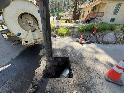
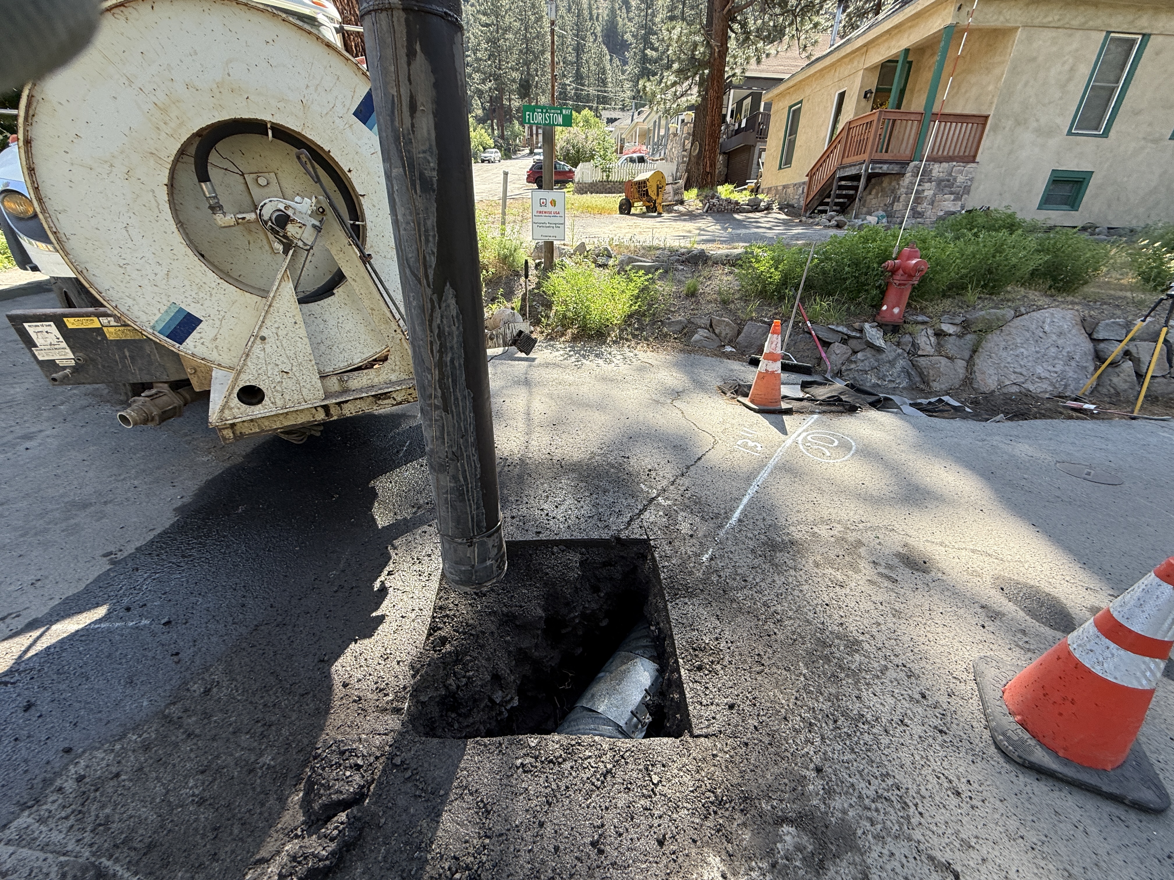
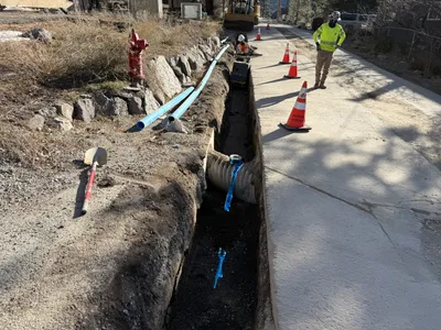
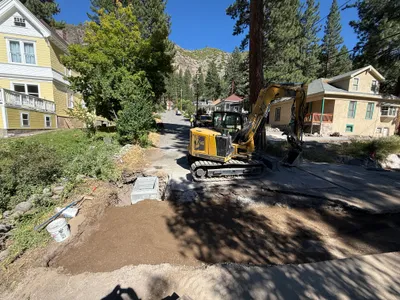
The image shows a vacuum excavation truck being used for utility potholing. The truck is positioned next to a square hole in the pavement, where a pipe is visible. Traffic cones are placed around the work area, indicating ongoing activities. A house is seen in the background along with a fire hydrant.
excavation
paved road with excavated area clear weather with daylight convenient roadside access; residential area visible
Traffic cones are visible for traffic control around the open trench.
Equipment & Materials
AI Tags
Analyzed Apr 21, 2026
Nearby Photos
2m
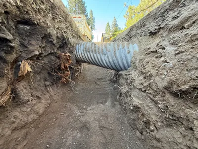
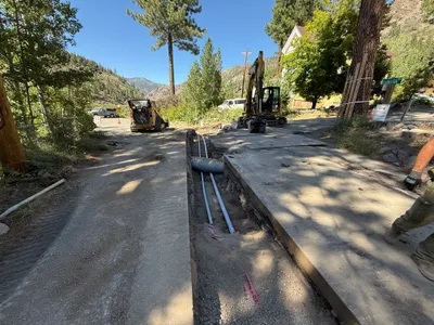
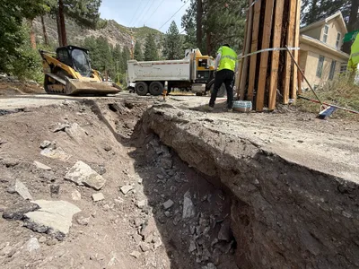
trenching
pipe-installationtrenching-activity
truck
2m
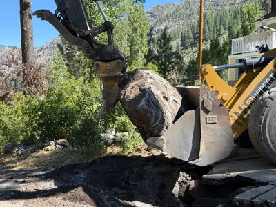
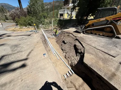
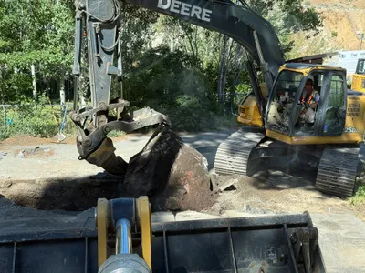
excavation
boulder-removalexcavation-activity
excavator
2m
trenching
trenchingroadway-excavation
shovel
2m
trenching
trenchingduct-bank-installation
skid steer loader
2m
trenching
trenchingconduit-installation
mini excavator
2m
backfill
trench-backfillingmanual-soil-work
excavator
3m
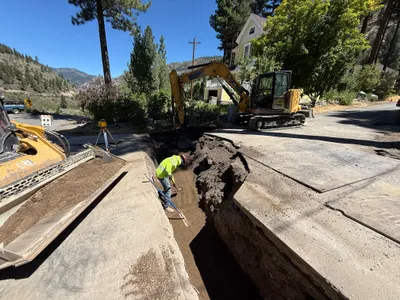
excavation
excavationtrenching
excavator
3m
excavation
excavationtree-protection
skid-steer
3m
excavation
rock-liftingexcavation-work
excavator
3m
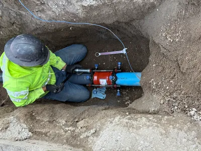
pipeline installation
pipeline-installationtool-usage
wrench