
No caption
IMG_8049.JPG
Details
Tuesday, May 27, 2025 · 9:09 AM
39.39468, -120.02269· 1638m
Location Context
1 / 5
USGS Topo
No elevation data
FEMA Flood
No flood data
OSM Infra
No address data
USDA Soil
No soil data
USGS Hydro
No hydro data
Apple iPhone 16 Pro
iPhone 16 Pro back triple camera 6.765mm f/1.78
6.764999865652793mmf/1.7799999713880651/242sISO 125
Flash did not fire, compulsory flash mode
Show all EXIF (43 fields)
ApertureValue1.6638
BrightnessValue4.6766
ColorSpace65535
CompositeImageGeneral Composite Image
ExifImageHeight3024
ExifVersion2.3.2
ExposureCompensation0
ExposureModeAuto
ExposureProgramNormal program
FlashpixVersion1.0
FocalLengthIn35mmFormat48
GPSDateStamp2025:05:27
GPSDestBearing99.1189
GPSDestBearingRefTrue North
GPSHPositioningError11.5801
GPSImgDirection99.1189
GPSImgDirectionRefT
GPSSpeed0.1342
GPSSpeedRefK
GPSTimeStamp16:9:27
HostComputeriPhone 16 Pro
latitude39.3947
LensInfo2.2200, 15.6600, 1.7800, 2.8000
LensMakeApple
longitude-120.0227
MeteringModePattern
ModifyDate2025-05-27T09:09:28.000Z
OffsetTime-07:00
OffsetTimeDigitized-07:00
OffsetTimeOriginal-07:00
ResolutionUnitinches
SceneCaptureTypeStandard
SceneTypeDirectly photographed
SensingMethodOne-chip color area sensor
ShutterSpeedValue7.9210
Software18.5
SubjectArea{"0":2011,"1":1508,"2":1106,"3":665}
SubSecTimeDigitized298
SubSecTimeOriginal298
WhiteBalanceAuto
XResolution72
YCbCrPositioning1
YResolution72
AI Analysis
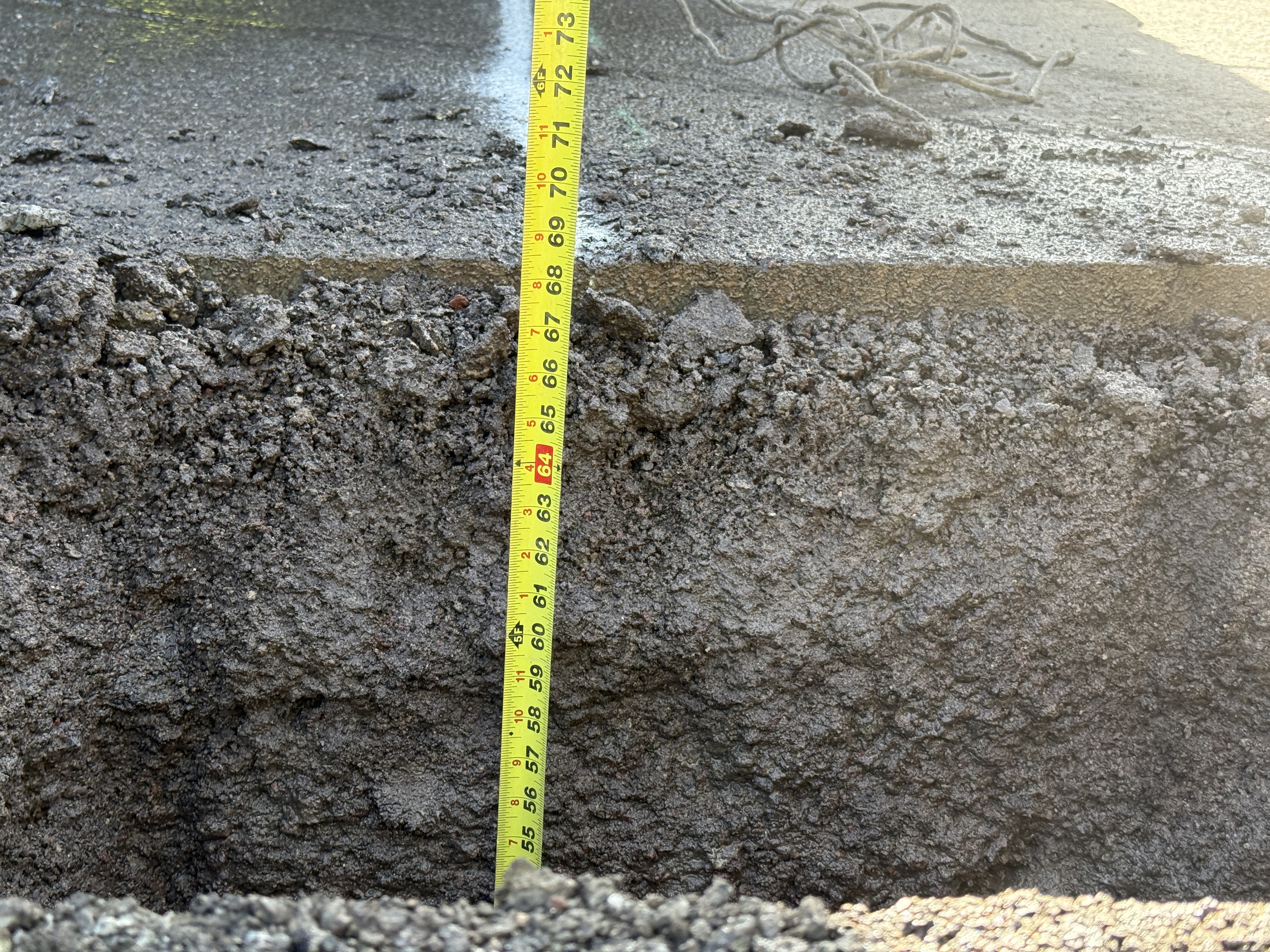
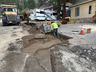
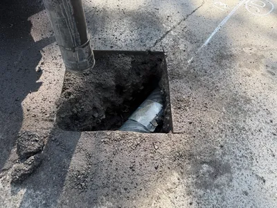
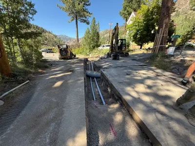
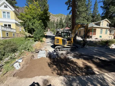
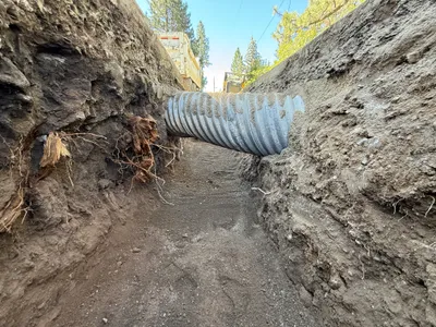
The image shows a vertical section of an excavation site, with a tape measure indicating the depth against the soil and layered material. The material appears to consist of a top layer of asphalt and underlying soil. The measuring tape displays a depth reading in the range of 55 to 73 inches approximately. Surrounding the measurement area is loose and uneven ground.
excavation
exposed soil and asphalt surface bright lighting with shadows open excavation area with loose ground
No safety features are visible in frame.
Equipment & Materials
Analyzed Apr 21, 2026
Nearby Photos
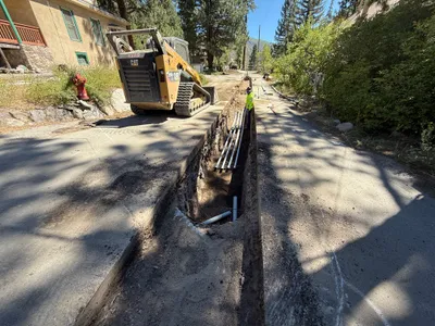
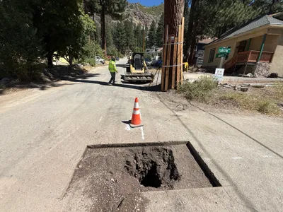
trenching
trenchingconduit-installation
tracked loader
3m
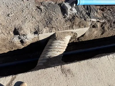
trenching
trenchingpipe-laying
corrugated-pipe
3m
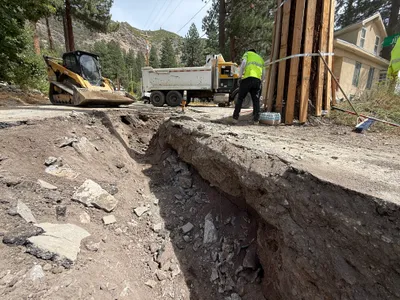
excavation
excavationtree-protection
skid-steer
3m
trenching
soil-compactiontrenching
backhoe
3m
excavation
pothole-utility-locatingvacuum-excavation
vacuum excavator
3m
trenching
trenchingduct-bank-installation
skid steer loader
3m
excavation
excavationtrenching
excavator
3m
trenching
pipe-installationtrenching-activity
truck
3m
excavation
pothole-excavationutility-locating
backhoe
3m
other
truckroad
truck