
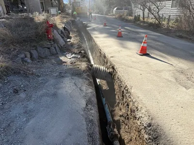
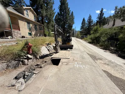
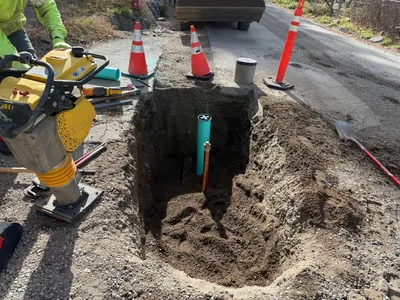
No caption
IMG_8045.JPG
Details
Tuesday, May 27, 2025 · 8:44 AM
39.39469, -120.02291· 1639m
Location Context
1 / 5
USGS Topo
No elevation data
FEMA Flood
No flood data
OSM Infra
No address data
USDA Soil
No soil data
USGS Hydro
No hydro data
Apple iPhone 16 Pro
iPhone 16 Pro back triple camera 6.765mm f/1.78
6.764999865652793mmf/1.7799999713880651/210sISO 160
Flash did not fire, compulsory flash mode
Show all EXIF (43 fields)
ApertureValue1.6638
BrightnessValue3.9660
ColorSpace65535
CompositeImageGeneral Composite Image
ExifImageHeight3024
ExifVersion2.3.2
ExposureCompensation0
ExposureModeAuto
ExposureProgramNormal program
FlashpixVersion1.0
FocalLengthIn35mmFormat48
GPSDateStamp2025:05:27
GPSDestBearing183.5660
GPSDestBearingRefTrue North
GPSHPositioningError69.2592
GPSImgDirection183.5660
GPSImgDirectionRefT
GPSSpeed0
GPSSpeedRefK
GPSTimeStamp15:44:34
HostComputeriPhone 16 Pro
latitude39.3947
LensInfo2.2200, 15.6600, 1.7800, 2.8000
LensMakeApple
longitude-120.0229
MeteringModePattern
ModifyDate2025-05-27T08:44:35.000Z
OffsetTime-07:00
OffsetTimeDigitized-07:00
OffsetTimeOriginal-07:00
ResolutionUnitinches
SceneCaptureTypeStandard
SceneTypeDirectly photographed
SensingMethodOne-chip color area sensor
ShutterSpeedValue7.7136
Software18.5
SubjectArea{"0":2011,"1":1508,"2":1106,"3":665}
SubSecTimeDigitized345
SubSecTimeOriginal345
WhiteBalanceAuto
XResolution72
YCbCrPositioning1
YResolution72
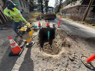
AI Analysis
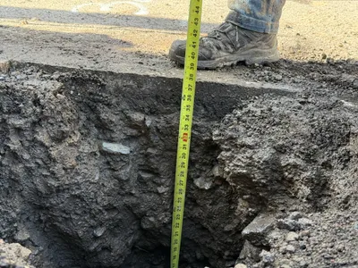
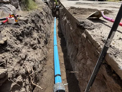
The image shows a pothole excavation with a measuring tape indicating the depth of the trench. A person is standing at the edge, wearing work boots. The soil appears compacted and the trench is unevenly cut. Depth measurement is being conducted, likely for utility locating purposes.
excavation
compacted uneven soil and pavement daylight conditions open trench access
Limited visible PPE; work boots are worn, but no additional safety controls are visible in the frame.
Equipment & Materials
AI Tags
Analyzed Apr 21, 2026
Nearby Photos
3m
trenching
trenchingexcavation
excavator
7m
excavation
pothole-utility-locatingtrench
excavator
8m
trenching
compactiontrench-preparation
compaction-machine
8m
backfill
compactiontrench-excavation
compactor
9m
trenching
trenchingpipeline-preparation
excavator
13m
trenching
trenchingpipeline-installation
construction vehicle
13m
trenching
trenchingexcavation
excavator
13m
trenching
trenchingpipeline-installation
shovel
13m
trenching
trenchingexcavation
excavator
14m
excavation
excavationtrenching
excavator