
No caption
IMG_8025 2.JPG
Details
Friday, May 23, 2025 · 2:20 PM
39.39469, -120.02236· 1633m
Location Context
1 / 5
USGS Topo
No elevation data
FEMA Flood
No flood data
OSM Infra
No address data
USDA Soil
No soil data
USGS Hydro
No hydro data
Apple iPhone 16 Pro
iPhone 16 Pro back triple camera 6.765mm f/1.78
6.764999865652793mmf/1.7799999713880651/1230sISO 80
Flash did not fire, compulsory flash mode
Show all EXIF (43 fields)
ApertureValue1.6638
BrightnessValue7.8784
ColorSpace65535
CompositeImageGeneral Composite Image
ExifImageHeight4284
ExifVersion2.3.2
ExposureCompensation0
ExposureModeAuto
ExposureProgramNormal program
FlashpixVersion1.0
FocalLengthIn35mmFormat24
GPSDateStamp2025:05:23
GPSDestBearing198.1923
GPSDestBearingRefTrue North
GPSHPositioningError4.7982
GPSImgDirection198.1923
GPSImgDirectionRefT
GPSSpeed0.1343
GPSSpeedRefK
GPSTimeStamp21:20:35
HostComputeriPhone 16 Pro
latitude39.3947
LensInfo2.2200, 15.6600, 1.7800, 2.8000
LensMakeApple
longitude-120.0224
MeteringModePattern
ModifyDate2025-05-23T14:20:35.000Z
OffsetTime-07:00
OffsetTimeDigitized-07:00
OffsetTimeOriginal-07:00
ResolutionUnitinches
SceneCaptureTypeStandard
SceneTypeDirectly photographed
SensingMethodOne-chip color area sensor
ShutterSpeedValue10.2645
Software18.5
SubjectArea{"0":2851,"1":2137,"2":3141,"3":1884}
SubSecTimeDigitized697
SubSecTimeOriginal697
WhiteBalanceAuto
XResolution72
YCbCrPositioning1
YResolution72
AI Analysis
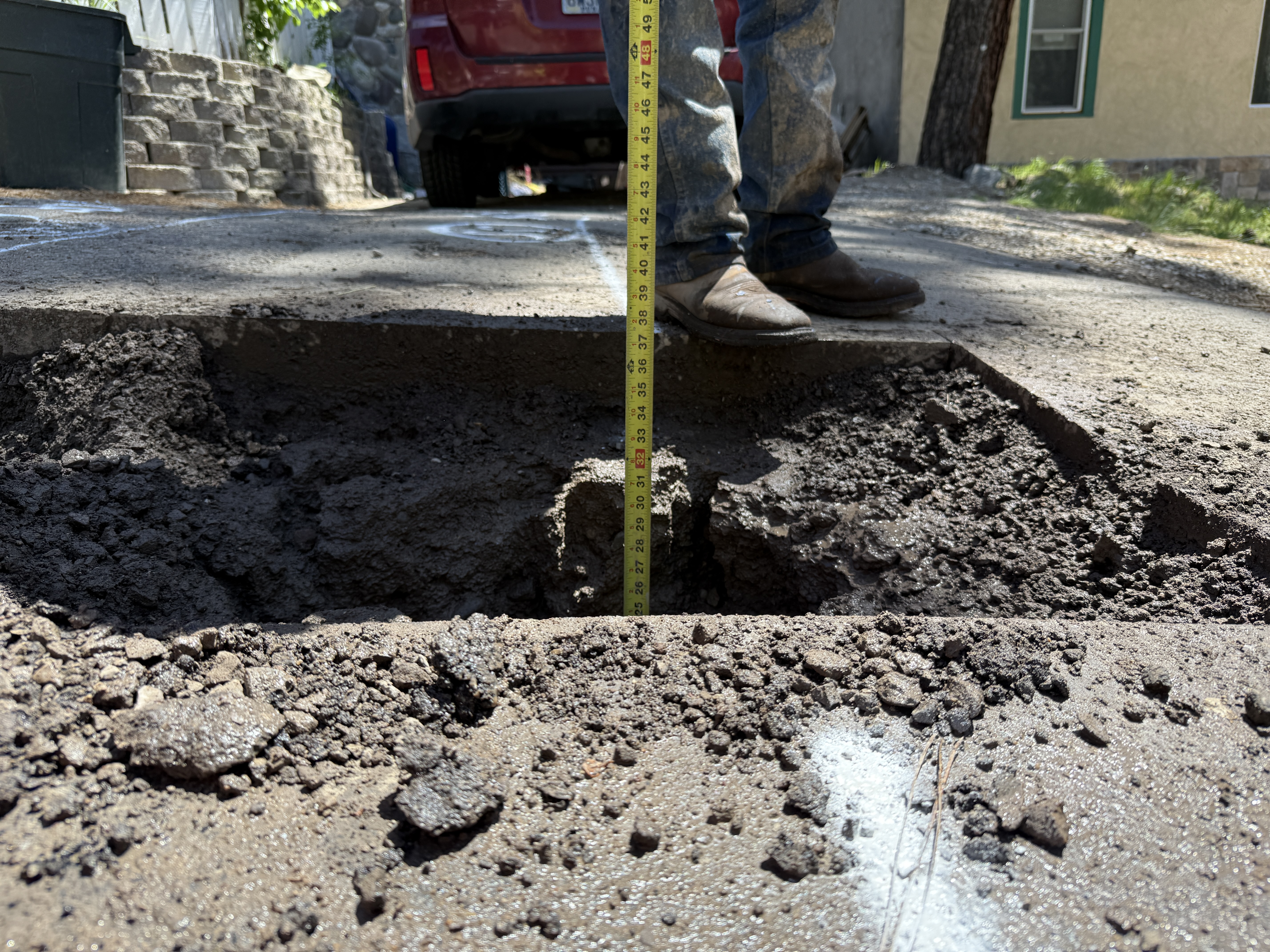
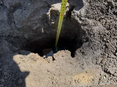
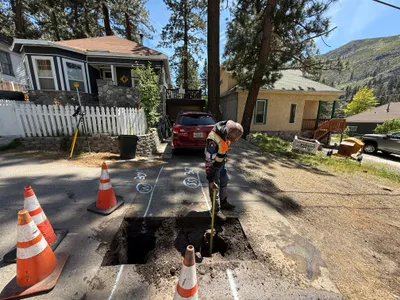
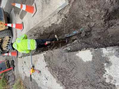
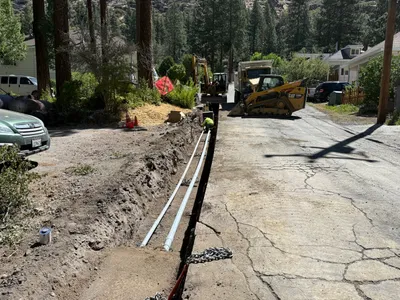
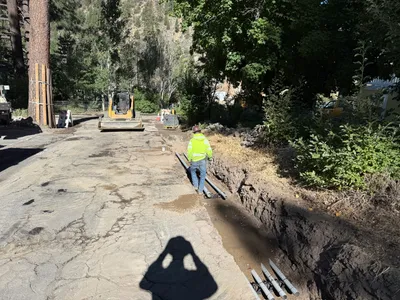
In the foreground, a partially excavated pothole on a road surface is shown. A person is using a measuring tape to determine the depth of the pothole. Asphalt surrounds the pothole edges, and disturbed soil is visible inside. A vehicle is parked in the background. This appears to be a utility locating activity, but this is not visibly confirmed.
excavation
asphalt with exposed soil daylight with shadows no apparent congestion
Minimal safety features visible; person is wearing work boots.
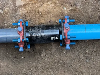
Equipment & Materials
AI Tags
Analyzed Apr 21, 2026
Nearby Photos
1m
excavation
pothole-utility-locatingdepth-measurement
measuring-tape
1m
excavation
pothole-utility-locatingtrench-measuring
red-car
1m
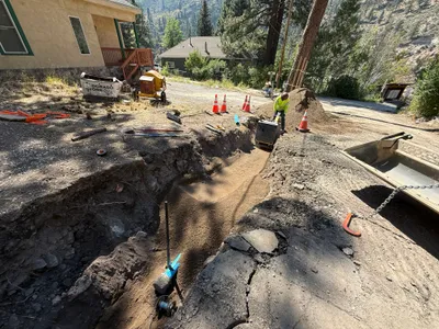
trenching
trenchingcompacting
compacting-machine
1m
trenching
trenchingpipeline-work
excavator
2m
paving surface restoration
surface-restorationpavement-repair
compact-excavator
2m
excavation
utility-locatingpotholing
excavator
2m
trenching
pipe-installationtrenching
construction vehicle
2m
trenching
trenchingduct-bank-installation
backhoe
3m
trenching
trenchinginspection
compact track loader
3m
pipeline installation
pipeline-connectionpipe-installation
pipes