
No caption
IMG_8013 2.JPG
Details
Friday, May 23, 2025 · 1:42 PM
39.39470, -120.02199· 1642m
Location Context
1 / 5
USGS Topo
No elevation data
FEMA Flood
No flood data
OSM Infra
No address data
USDA Soil
No soil data
USGS Hydro
No hydro data
Apple iPhone 16 Pro
iPhone 16 Pro back triple camera 6.765mm f/1.78
6.764999865652793mmf/1.7799999713880651/443sISO 100
Flash did not fire, compulsory flash mode
Show all EXIF (43 fields)
ApertureValue1.6638
BrightnessValue5.8472
ColorSpace65535
CompositeImageGeneral Composite Image
ExifImageHeight4284
ExifVersion2.3.2
ExposureCompensation0
ExposureModeAuto
ExposureProgramNormal program
FlashpixVersion1.0
FocalLengthIn35mmFormat24
GPSDateStamp2025:05:23
GPSDestBearing196.2230
GPSDestBearingRefTrue North
GPSHPositioningError6.5663
GPSImgDirection196.2230
GPSImgDirectionRefT
GPSSpeed0
GPSSpeedRefK
GPSTimeStamp20:42:15
HostComputeriPhone 16 Pro
latitude39.3947
LensInfo2.2200, 15.6600, 1.7800, 2.8000
LensMakeApple
longitude-120.0220
MeteringModePattern
ModifyDate2025-05-23T13:42:15.000Z
OffsetTime-07:00
OffsetTimeDigitized-07:00
OffsetTimeOriginal-07:00
ResolutionUnitinches
SceneCaptureTypeStandard
SceneTypeDirectly photographed
SensingMethodOne-chip color area sensor
ShutterSpeedValue8.7901
Software18.5
SubjectArea{"0":2851,"1":2137,"2":3141,"3":1884}
SubSecTimeDigitized435
SubSecTimeOriginal435
WhiteBalanceAuto
XResolution72
YCbCrPositioning1
YResolution72
AI Analysis
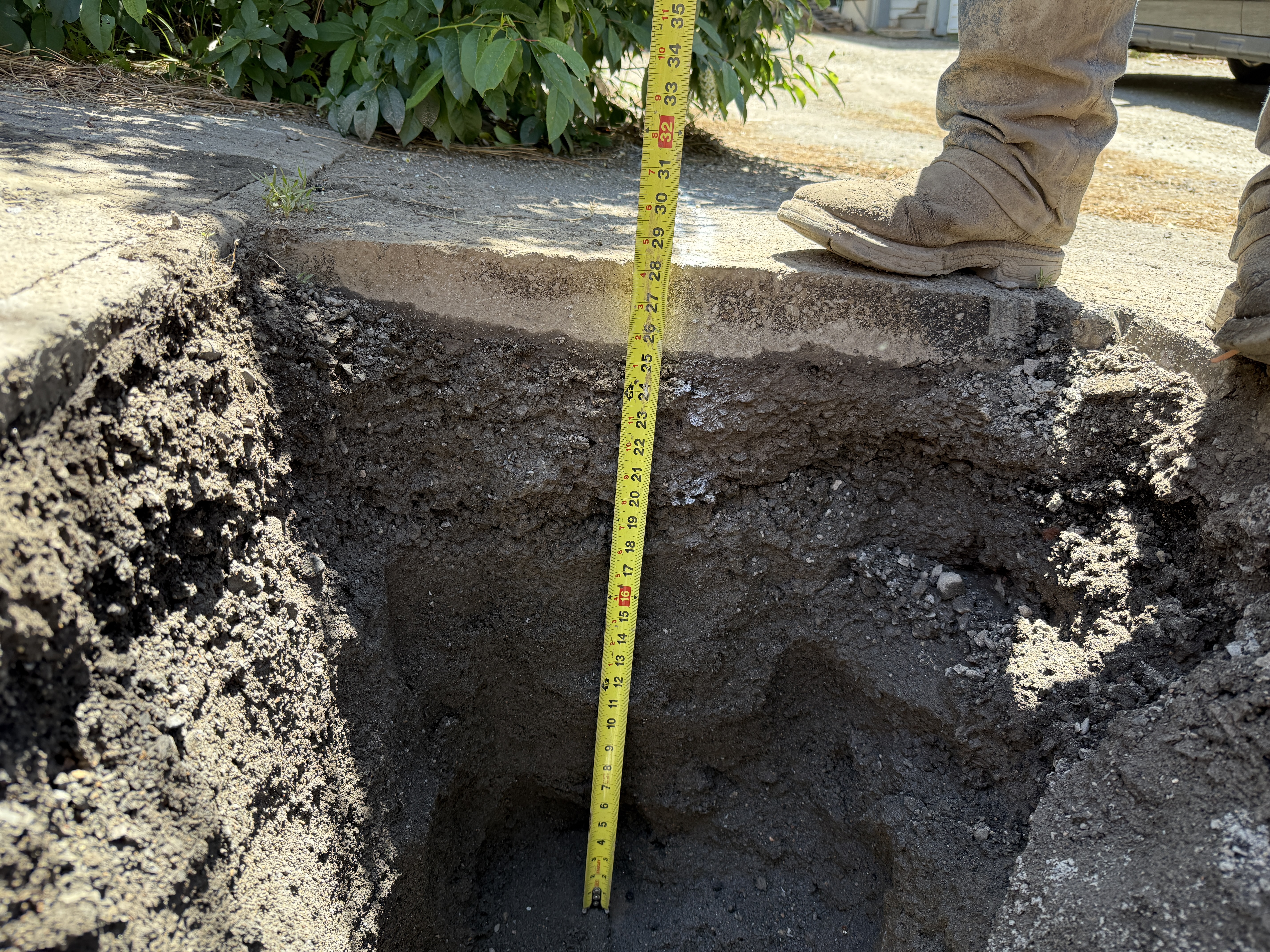
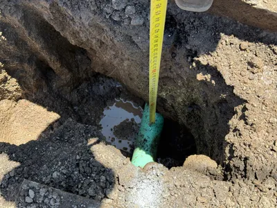
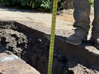
The image shows a pothole excavation with a measuring tape indicating the depth of the hole next to a concrete sidewalk. A person's feet are visible at the edge of the excavation, standing on the sidewalk. The soil layers are clearly visible, showing different strata. The potholing appears to be for utility locating purposes.
excavation
exposed soil and concrete pavement bright daylight unobstructed access next to sidewalk
No visible safety controls are present in the frame except for work-boots as PPE.
Equipment & Materials
AI Tags
Analyzed Apr 21, 2026
Nearby Photos
0m
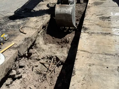
trenching
trenchingexcavation
excavator
0m
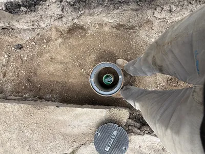
excavation
pothole-excavationutility-locating
soil
1m
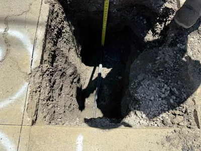
excavation
pothole-utility-locatingmeasurement
SUV
1m
excavation
potholingutility-locating
measuring-tape
2m
excavation
pothole-utility-locatingtrench-measurement
black SUV
2m
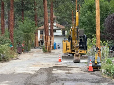
trenching
trenchingconduit-installation
backhoe
3m
trenching
trenchingutility-installation
excavator
3m
excavation
excavationaccess-point-installation
access-point
3m
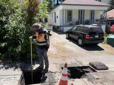
trenching
trench-measuringdepth-check
measuring-tape
4m
site grading
equipment-stagingsite-access-preparation
excavator