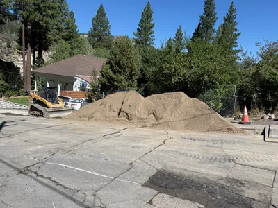
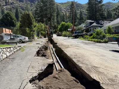
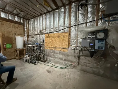
No caption
IMG_7997 2.JPG
Details
Friday, May 23, 2025 · 1:08 PM
39.39454, -120.02195· 1652m
Location Context
1 / 5
USGS Topo
No elevation data
FEMA Flood
No flood data
OSM Infra
No address data
USDA Soil
No soil data
USGS Hydro
No hydro data
Apple iPhone 16 Pro
iPhone 16 Pro back triple camera 6.765mm f/1.78
6.764999865652793mmf/1.7799999713880651/3425sISO 80
Flash did not fire, compulsory flash mode
Show all EXIF (43 fields)
ApertureValue1.6638
BrightnessValue9.3893
ColorSpace65535
CompositeImageGeneral Composite Image
ExifImageHeight4284
ExifVersion2.3.2
ExposureCompensation0
ExposureModeAuto
ExposureProgramNormal program
FlashpixVersion1.0
FocalLengthIn35mmFormat24
GPSDateStamp2025:05:23
GPSDestBearing330.1023
GPSDestBearingRefTrue North
GPSHPositioningError37.4395
GPSImgDirection330.1023
GPSImgDirectionRefT
GPSSpeed0
GPSSpeedRefK
GPSTimeStamp20:8:9
HostComputeriPhone 16 Pro
latitude39.3945
LensInfo2.2200, 15.6600, 1.7800, 2.8000
LensMakeApple
longitude-120.0220
MeteringModePattern
ModifyDate2025-05-23T13:08:11.000Z
OffsetTime-07:00
OffsetTimeDigitized-07:00
OffsetTimeOriginal-07:00
ResolutionUnitinches
SceneCaptureTypeStandard
SceneTypeDirectly photographed
SensingMethodOne-chip color area sensor
ShutterSpeedValue11.7417
Software18.5
SubjectArea{"0":2851,"1":2137,"2":3141,"3":1884}
SubSecTimeDigitized826
SubSecTimeOriginal826
WhiteBalanceAuto
XResolution72
YCbCrPositioning1
YResolution72
AI Analysis
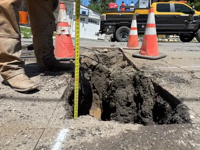
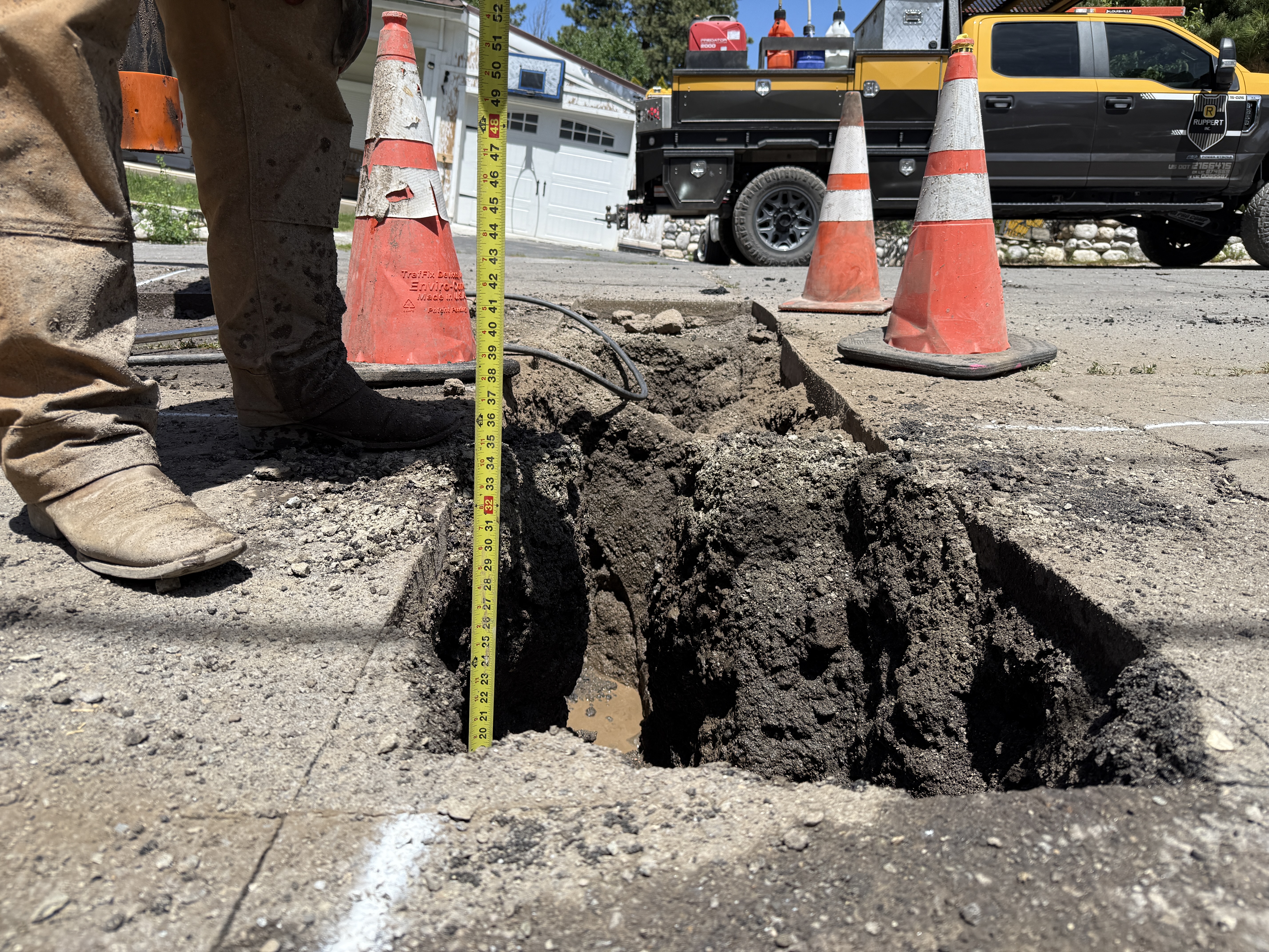
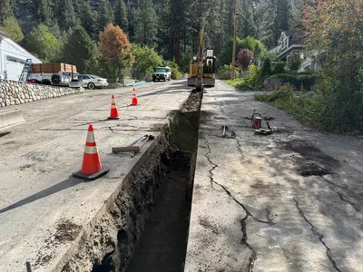
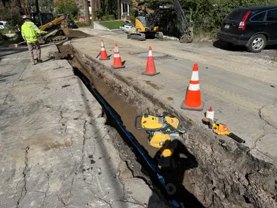
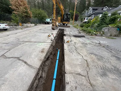
A worker is measuring the depth of an open trench or pothole using a measuring tape. Three traffic cones surround the excavation site, serving as safety markers. A truck is parked nearby, possibly used by the crew. The ground is paved, and the trench is visibly dug into it.
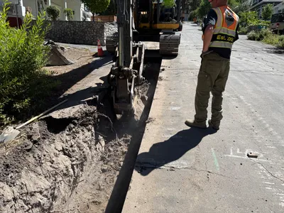
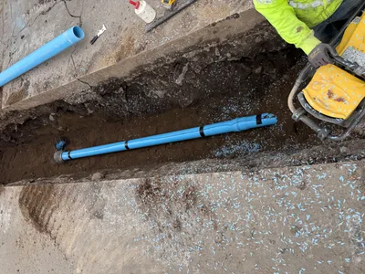
trenching
paved surface with open trench clear day with bright sunlight coned area restricting access
Cones are used for marking the area around the open trench.
Equipment & Materials
AI Tags
Analyzed Apr 21, 2026
Nearby Photos
2m
trenching
trenchingconduit-installation
backhoe-loader
4m
trenching
trenchingpipe-laying
excavator
6m
trenching
trenchingroad excavation
excavator
7m
trenching
trenchingexcavation
excavator
8m
pipeline installation
pipeline-installationtrenching
compaction machine
8m
trenching
trenchingroad-work
compact-excavator
9m
trenching
trenchingpipeline-installation
excavator
9m
site grading
gradingsoil-moving
skid steer loader
9m
trenching
trenchingexcavation
excavator
9m
mechanical installation
filtration-setupequipment-installation
insulation-materials