
No caption
IMG_1666.JPG
Details
Wednesday, November 19, 2025 · 9:46 AM
39.39462, -120.02165· 1668m
Location Context
1 / 5
USGS Topo
No elevation data
FEMA Flood
No flood data
OSM Infra
No address data
USDA Soil
No soil data
USGS Hydro
No hydro data
Apple iPhone 16 Pro
iPhone 16 Pro back triple camera 6.765mm f/1.78
6.764999865652793mmf/1.7799999713880651/326sISO 80
Flash did not fire, compulsory flash mode
Show all EXIF (43 fields)
ApertureValue1.6638
BrightnessValue6.0270
ColorSpace65535
CompositeImageGeneral Composite Image
ExifImageHeight4284
ExifVersion2.3.2
ExposureCompensation0
ExposureModeAuto
ExposureProgramNormal program
FlashpixVersion1.0
FocalLengthIn35mmFormat24
GPSDateStamp2025:11:19
GPSDestBearing248.6008
GPSDestBearingRefTrue North
GPSHPositioningError22.5715
GPSImgDirection248.6008
GPSImgDirectionRefT
GPSSpeed0.2071
GPSSpeedRefK
GPSTimeStamp17:46:10
HostComputeriPhone 16 Pro
latitude39.3946
LensInfo2.2200, 15.6600, 1.7800, 2.8000
LensMakeApple
longitude-120.0217
MeteringModePattern
ModifyDate2025-11-19T09:46:12.000Z
OffsetTime-08:00
OffsetTimeDigitized-08:00
OffsetTimeOriginal-08:00
ResolutionUnitinches
SceneCaptureTypeStandard
SceneTypeDirectly photographed
SensingMethodOne-chip color area sensor
ShutterSpeedValue8.3490
Software26.1
SubjectArea{"0":2847,"1":2131,"2":3142,"3":1881}
SubSecTimeDigitized304
SubSecTimeOriginal304
WhiteBalanceAuto
XResolution72
YCbCrPositioning1
YResolution72
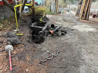
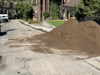
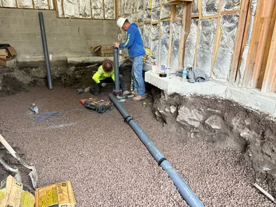
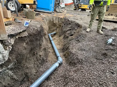
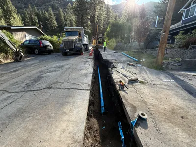
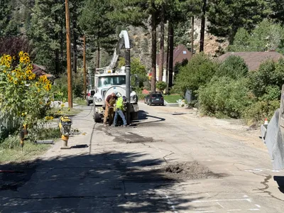
AI Analysis
The image shows an open trench next to utility poles and a road. Caution tape is present around the excavation area, indicating safety measures. Several pipes and large rocks are displaced near the trench. Utility structures and vehicles are visible in the background, suggesting ongoing work in the area.
trenching
unpaved road with trench and some rocks overcast partially obstructed by excavation materials
Caution tape is used to mark the open trench area.
Analyzed Apr 21, 2026
Nearby Photos
1m
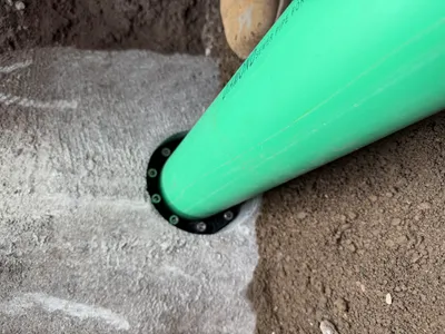
pipeline installation
pipeline-installationgreen pipe
compacted soil
2m
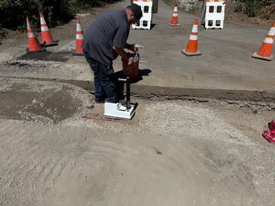
inspection documentation
compaction-testingsoil-gravel-testing
compaction-test-device
3m
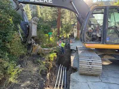
trenching
trenchinginspection
excavator
3m
site grading
soil-deliveryroad-access-obstruction
soil
3m
pipeline installation
pipe-installationindoor-work
power-tool
3m
pipeline installation
pipeline-installationtrenching
excavator
3m
trenching
trenchingpipe-laying
excavator
4m
excavation
pothole-locatingutility-excavation
vacuum-truck
4m
trenching
trenchingsoil-removal
excavator
4m
trenching
trenchingconduit-placement
pickup-truck