No caption
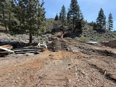
IMG_7805.JPG
Details
Thursday, May 15, 2025 · 4:26 PM
39.39236, -120.02253· 1635m
Location Context
1 / 5
USGS Topo
No elevation data
FEMA Flood
No flood data
OSM Infra
No address data
USDA Soil
No soil data
USGS Hydro
No hydro data
Apple iPhone 16 Pro
iPhone 16 Pro back triple camera 2.22mm f/2.2
2.220000028611935mmf/2.21/3125sISO 50
Flash did not fire, compulsory flash mode
Show all EXIF (43 fields)
ApertureValue2.2750
BrightnessValue8.4768
ColorSpace65535
CompositeImageGeneral Composite Image
ExifImageHeight3024
ExifVersion2.3.2
ExposureCompensation0
ExposureModeAuto
ExposureProgramNormal program
FlashpixVersion1.0
FocalLengthIn35mmFormat14
GPSDateStamp2025:05:15
GPSDestBearing229.8301
GPSDestBearingRefTrue North
GPSHPositioningError4.7487
GPSImgDirection229.8301
GPSImgDirectionRefT
GPSSpeed0.4305
GPSSpeedRefK
GPSTimeStamp23:26:5
HostComputeriPhone 16 Pro
latitude39.3924
LensInfo2.2200, 15.6600, 1.7800, 2.8000
LensMakeApple
longitude-120.0225
MeteringModeSpot
ModifyDate2025-05-15T16:26:06.000Z
OffsetTime-07:00
OffsetTimeDigitized-07:00
OffsetTimeOriginal-07:00
ResolutionUnitinches
SceneCaptureTypeStandard
SceneTypeDirectly photographed
SensingMethodOne-chip color area sensor
ShutterSpeedValue11.6096
Software18.5
SubjectArea{"0":3637,"1":2646,"2":751,"3":756}
SubSecTimeDigitized369
SubSecTimeOriginal369
WhiteBalanceAuto
XResolution72
YCbCrPositioning1
YResolution72
AI Analysis
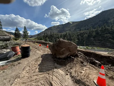
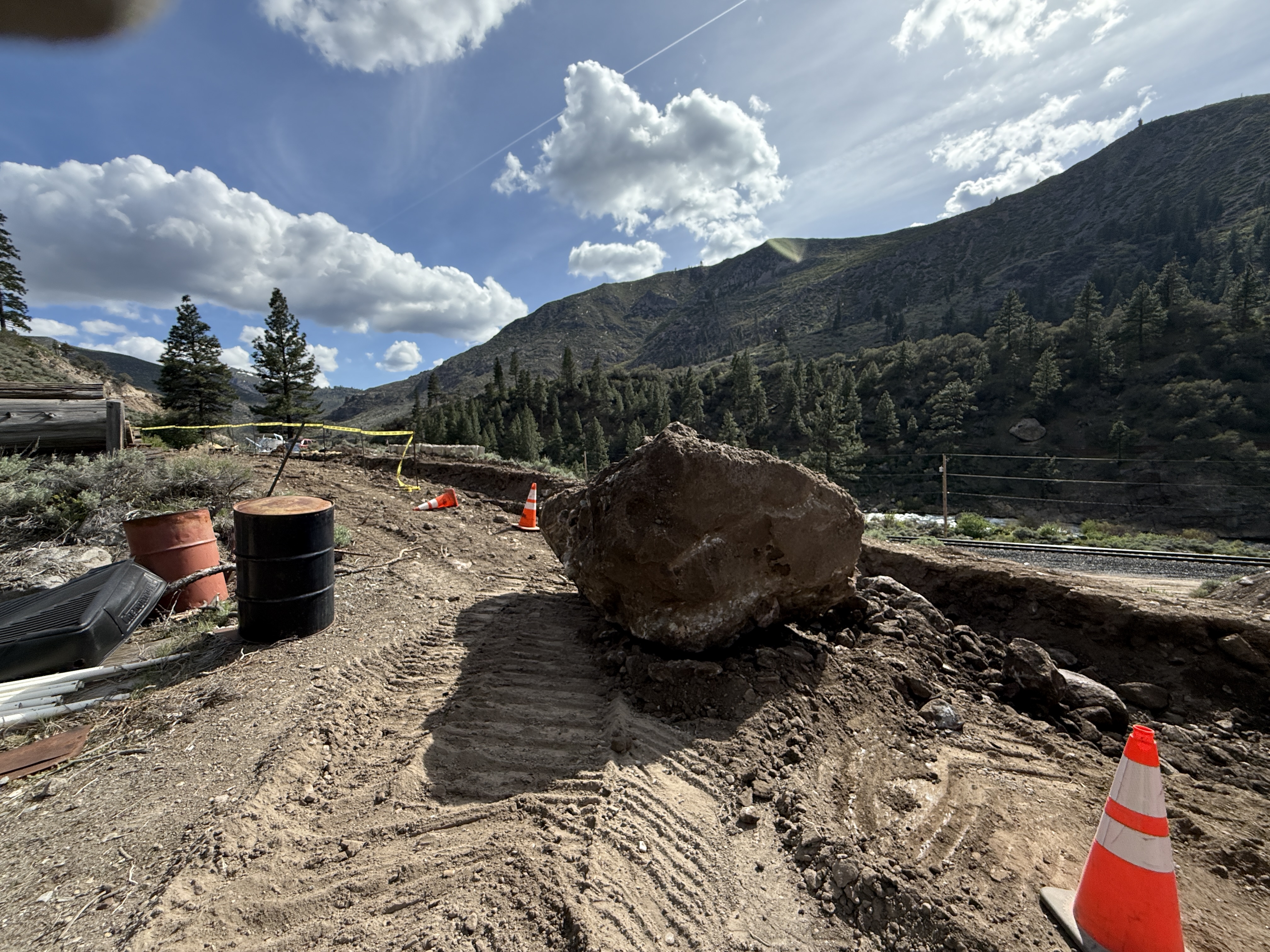
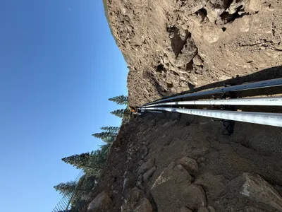
The image shows a large boulder positioned prominently at a site that appears to be undergoing excavation. Soil is visibly disturbed with track marks, suggesting equipment operation. Traffic cones and barrels are placed near the boulder, and yellow caution tape is visible in the background. There is no heavy equipment or vehicles in the immediate frame.
excavation
disturbed soil with track marks clear skies with good natural lighting area is open with no visible congestion
Traffic cones and caution tape are visible, but no PPE is seen in the frame.
AI Tags
Analyzed Apr 21, 2026
Nearby Photos
1m
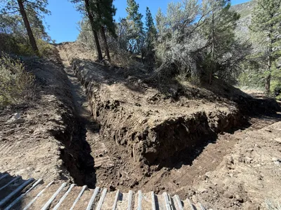
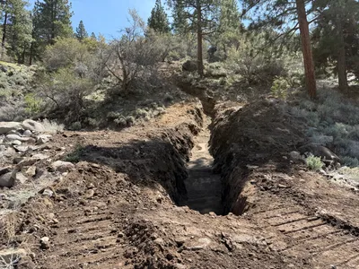
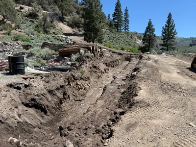
trenching
trenchingexcavation
2m
trenching
trenchingexcavation
dirt
2m
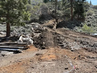
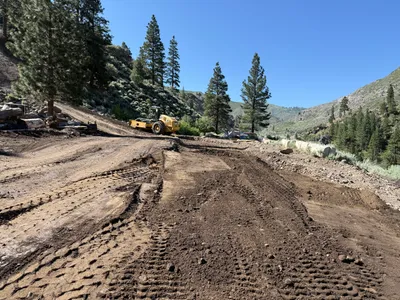
site grading
site-clearingsoil-disturbance
lumber
2m
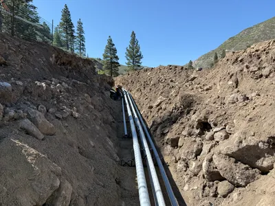
pipeline installation
duct-installationpipe-laying
rocky soil
4m
trenching
trenchingexcavation
4m
site grading
site-gradingheavy-equipment
roller
5m
pipeline installation
pipe-layingtrenching
pipes
5m
trenching
trenchinglogs
5m
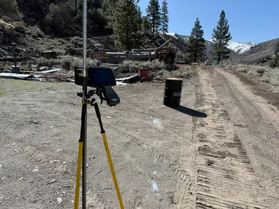
survey layout
survey-layoutequipment-setup
surveying-equipment
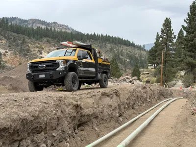
6m
trenching
trenchingpipe-laying
utility-truck