No caption
IMG_9229.JPG
Details
Thursday, August 7, 2025 · 11:05 AM
39.39456, -120.02252· 1637m
Location Context
1 / 5
USGS Topo
No elevation data
FEMA Flood
No flood data
OSM Infra
No address data
USDA Soil
No soil data
USGS Hydro
No hydro data
Apple iPhone 16 Pro
iPhone 16 Pro back triple camera 6.765mm f/1.78
6.764999865652793mmf/1.7799999713880651/1271sISO 80
Flash did not fire, compulsory flash mode
Show all EXIF (43 fields)
ApertureValue1.6638
BrightnessValue7.9092
ColorSpace65535
CompositeImageGeneral Composite Image
ExifImageHeight4284
ExifVersion2.3.2
ExposureCompensation0
ExposureModeAuto
ExposureProgramNormal program
FlashpixVersion1.0
FocalLengthIn35mmFormat24
GPSDateStamp2025:08:07
GPSDestBearing106.8945
GPSDestBearingRefTrue North
GPSHPositioningError37.9040
GPSImgDirection106.8945
GPSImgDirectionRefT
GPSSpeed0
GPSSpeedRefK
GPSTimeStamp18:5:47
HostComputeriPhone 16 Pro
latitude39.3946
LensInfo2.2200, 15.6600, 1.7800, 2.8000
LensMakeApple
longitude-120.0225
MeteringModePattern
ModifyDate2025-08-07T11:05:49.000Z
OffsetTime-07:00
OffsetTimeDigitized-07:00
OffsetTimeOriginal-07:00
ResolutionUnitinches
SceneCaptureTypeStandard
SceneTypeDirectly photographed
SensingMethodOne-chip color area sensor
ShutterSpeedValue10.3113
Software18.6
SubjectArea{"0":2851,"1":2137,"2":3141,"3":1884}
SubSecTimeDigitized431
SubSecTimeOriginal431
WhiteBalanceAuto
XResolution72
YCbCrPositioning1
YResolution72
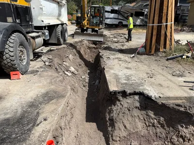
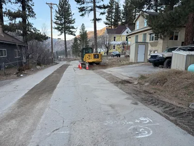
AI Analysis
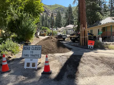
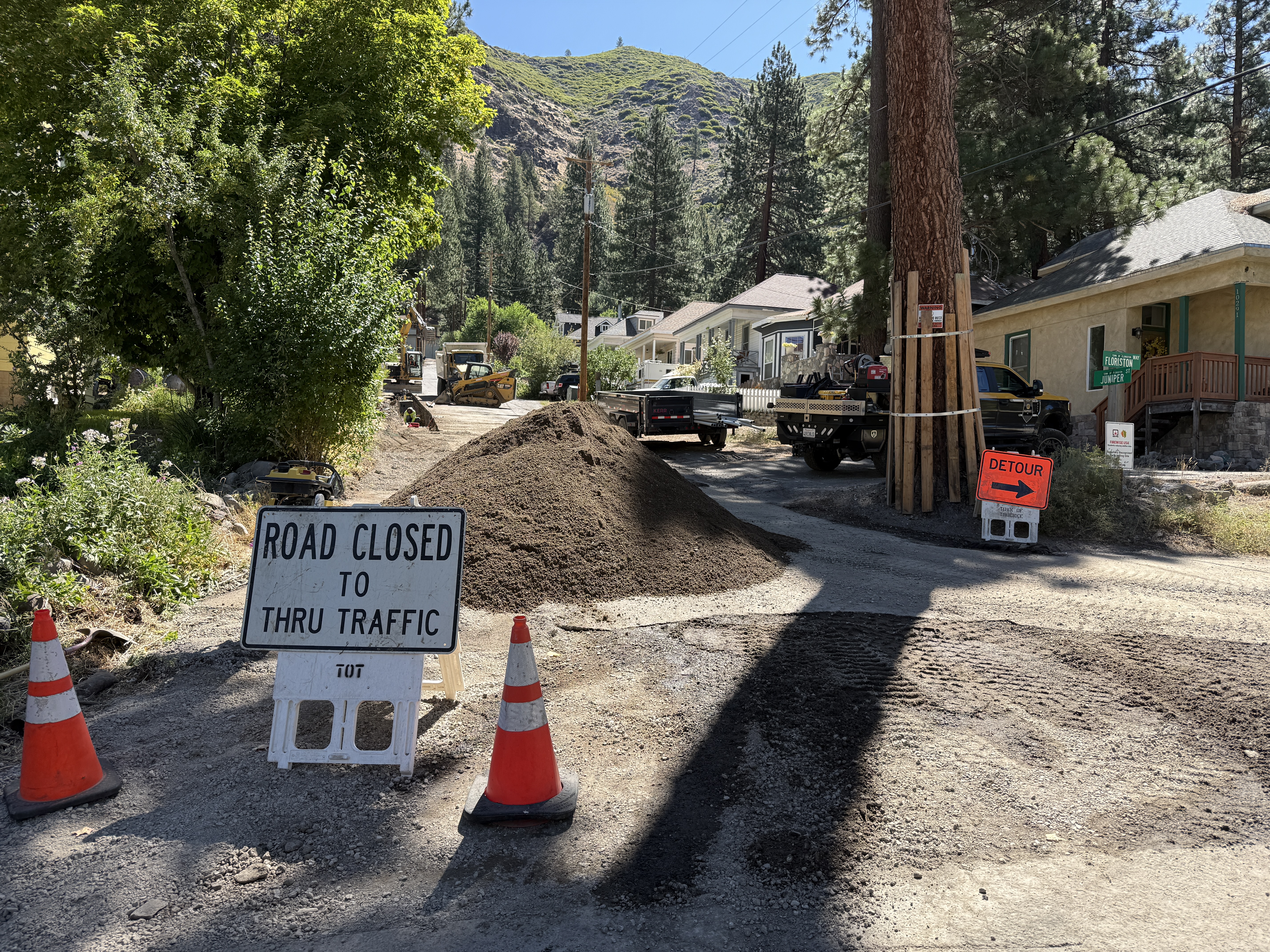
The image shows a road closed with a sign indicating closure to through traffic and an orange detour sign. Two orange cones are placed beside the road closed sign. A pile of dirt is blocking the road, indicating ongoing work. There is construction equipment and vehicles further down the road.
site-grading
gravel and dirt with road partly blocked sunny daylight conditions limited access due to road blockage
Traffic control measures like cones and signs are visible in the frame.
Analyzed Apr 21, 2026
Nearby Photos
2m
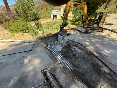
trenching
trench-compactiontrench
loader
4m
trenching
trenchingsoil-compaction
excavator
4m
trenching
trenchingexcavation
excavator
4m
trenching
trenching-activityconduit-laying
excavator
4m
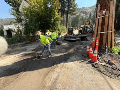
paving surface restoration
asphalt-spreadingsurface-restoration
skid-steer-loader
4m
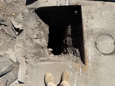
excavation
pothole-utility-locatingpothole
dirt
4m
trenching
trenchingpipeline-installation
yellow vehicle
4m
trenching
trenchingexcavation-work
excavator
4m
trenching
trenchingpipeline-installation
excavator
5m
paving surface restoration
equipment-stagingroad-preparation
compact-excavator