No caption
IMG_9070.JPG
Details
Thursday, July 31, 2025 · 3:07 PM
39.39158, -120.02153· 1670m
Location Context
1 / 5
USGS Topo
No elevation data
FEMA Flood
No flood data
OSM Infra
No address data
USDA Soil
No soil data
USGS Hydro
No hydro data
Apple iPhone 16 Pro
iPhone 16 Pro back triple camera 2.22mm f/2.2
2.220000028611935mmf/2.21/2320sISO 50
Flash did not fire, compulsory flash mode
Show all EXIF (43 fields)
ApertureValue2.2750
BrightnessValue9.8762
ColorSpace65535
CompositeImageGeneral Composite Image
ExifImageHeight3024
ExifVersion2.3.2
ExposureCompensation0
ExposureModeAuto
ExposureProgramNormal program
FlashpixVersion1.0
FocalLengthIn35mmFormat14
GPSDateStamp2025:07:31
GPSDestBearing94.4436
GPSDestBearingRefTrue North
GPSHPositioningError11.1470
GPSImgDirection94.4436
GPSImgDirectionRefT
GPSSpeed0.6677
GPSSpeedRefK
GPSTimeStamp22:7:35
HostComputeriPhone 16 Pro
latitude39.3916
LensInfo2.2200, 15.6600, 1.7800, 2.8000
LensMakeApple
longitude-120.0215
MeteringModePattern
ModifyDate2025-07-31T15:07:36.000Z
OffsetTime-07:00
OffsetTimeDigitized-07:00
OffsetTimeOriginal-07:00
ResolutionUnitinches
SceneCaptureTypeStandard
SceneTypeDirectly photographed
SensingMethodOne-chip color area sensor
ShutterSpeedValue11.1800
Software18.6
SubjectArea{"0":2000,"1":1511,"2":2217,"3":1330}
SubSecTimeDigitized181
SubSecTimeOriginal181
WhiteBalanceAuto
XResolution72
YCbCrPositioning1
YResolution72
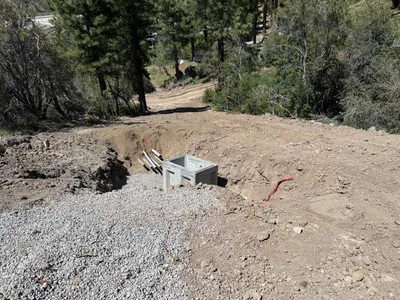
AI Analysis
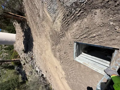
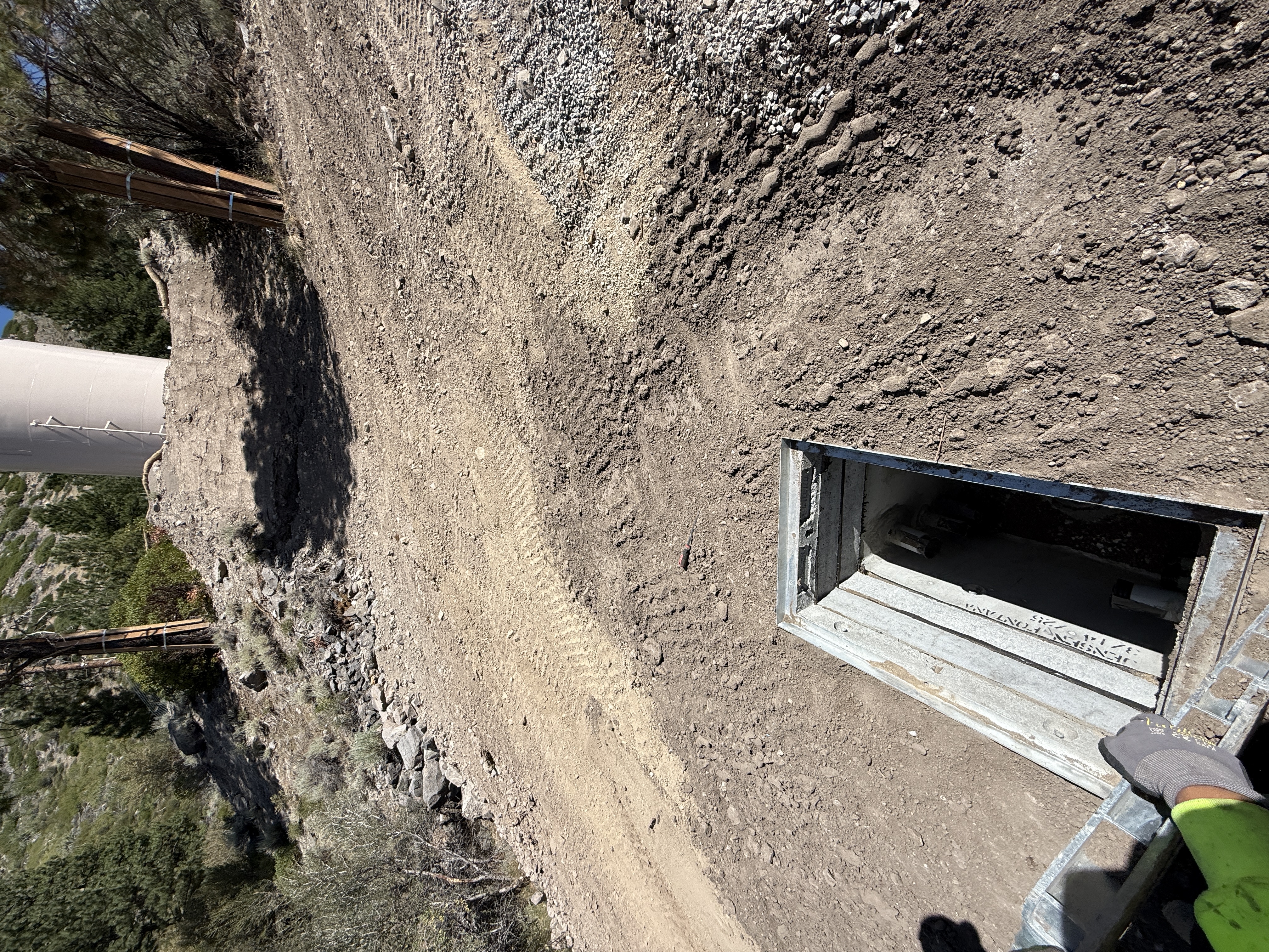
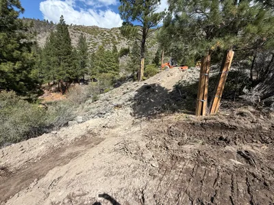
The image captures an open utility vault located in the middle of a dirt path with visible surrounding vegetation and a concrete structure uphill. The vault has a metal cover partially opened, exposing its interior. The surrounding ground is uneven but compacted, suggesting recent work. It is unclear what specific components the vault contains.
site-grading
compacted soil and dirt pathway clear daylight unobstructed access on dirt pathway
PPE like gloves is visible; no other safety controls are visible in frame.
Equipment & Materials
AI Tags
Analyzed Apr 21, 2026
Nearby Photos
1m
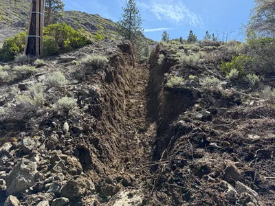
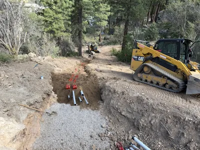
trenching
trenching-activitytrench
gravel
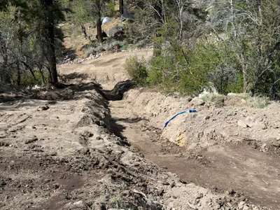
1m
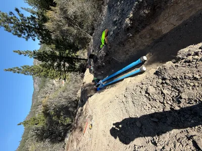
trenching
trenchingpipe-laying
blue pipes
1m
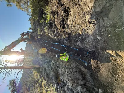
trenching
trenchingexcavation
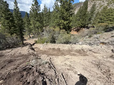
3m
trenching
trenchingterrain-preparation
3m
trenching
trenchingutility-installation
gravel
4m
trenching
trenchingutility-trench
soil
4m
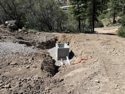
site grading
site-gradingerosion-control
orange machinery
4m
trenching
trenchingpipe-installation
CAT compact track loader
4m
trenching
trenchingsite-preparation
excavator
5m
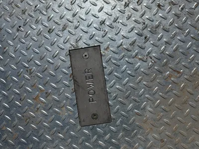
electrical
access-controlutility-access
access cover